Altkarte
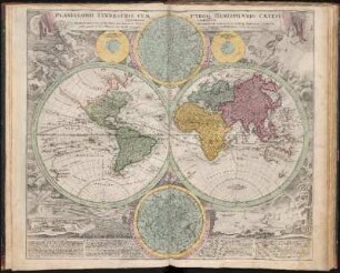
Planiglobii terrestris cum utroq hemisphaerio caelesti generalis repræsentatio. ; quam ex novissimis probatissimisque recentium Geographorum seriptis concinnatam multisq phaenomenis illustratam
- Location
-
Greifswald
- Collection
-
Kartensammlung des Instituts für Geographie und Geologie (Universität Greifswald)
- Inventory number
-
AltK/B10.00/2
- Material/Technique
-
Papierartig; Kupferstich, koloriert
- Inscription/Labeling
-
Verantwortlichkeitsangabe: publice proponit Io. Bapt. Homann
- Classification
-
Kartographie
- Subject (where)
-
Norimbergae, Noribergae, Nuremberg, Nürnberg
- Event
-
Herstellung
- (when)
-
1720 [ca. 1720]
- Last update
-
25.03.2025, 9:46 AM CET
Data provider
This object is provided by:
Universität Greifswald. Kartensammlung des Instituts für Geographie und Geologie. If you have any questions about the object, please contact the data provider.
Universität Greifswald. Kartensammlung des Instituts für Geographie und Geologie. If you have any questions about the object, please contact the data provider.
Object type
- Altkarte
Time of origin
- 1720 [ca. 1720]
Other Objects (12)
![Planiglobii Terrestris Cum Utroq Hemisphærio Cælesti Generalis Exhibitio : Quam ex novissimis probatissimisque Galorum & Batavorum Tabulis concinnatam, multisq[ue] phænomenis illustratam](https://iiif.deutsche-digitale-bibliothek.de/image/2/a3d6c871-28ed-430d-8ef1-10637f7ea7ab/full/!306,450/0/default.jpg)
Planiglobii Terrestris Cum Utroq Hemisphærio Cælesti Generalis Exhibitio : Quam ex novissimis probatissimisque Galorum & Batavorum Tabulis concinnatam, multisq[ue] phænomenis illustratam
Planiglobii Terrestris Cum Utroque Hemisphærio Cælesti Generalis Exhibitio : Quam ex novissimis probatissimisque recentium Geographorum scriptis concinnatam multisque phænomenis illustratam ; Cum Privilegio Sac. Caes. Majestatis

De caelesti ierarchia

Aria: Caelesti incendio amoris

Planiglobii terrestris cum utroque hemisphaerio caelesti generalis exhibitio Quam ex novissimis probatissimisque Gallorum et Batavorum Tabulis concinnatam multisque phaenomenis illustratam Luci publicae exponit Auctor Ioh Baptista Homann Norimbergae Allgemeine Karte der Erde Zeichner: Johann Baptist Homann, Nürnberg

De Phaenomenis.
Pars II. De Fluido Caelesti
Caput II. De Sphæra Cælesti.
Expositio Secvnda De Mvndo Caelesti.
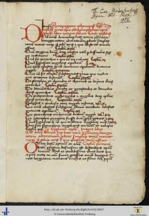
(1r - 22v) De Caelesti Hierarchia.
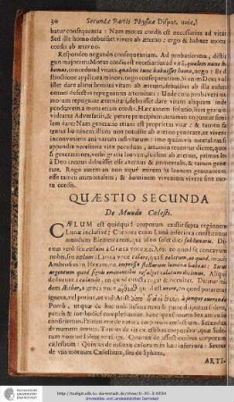
QUAESTIO SECUNDA. De Mundo Caelesti.

De caelesti exercitu triumphante oratio
Planiglobii Terrestris Cum Utroq Hemisphærio Cælesti Generalis Exhibitio : Quam ex novissimis probatissimisque Galorum & Batavorum Tabulis concinnatam, multisq[ue] phænomenis illustratam
Planiglobii Terrestris Cum Utroque Hemisphærio Cælesti Generalis Exhibitio : Quam ex novissimis probatissimisque recentium Geographorum scriptis concinnatam multisque phænomenis illustratam ; Cum Privilegio Sac. Caes. Majestatis
De caelesti ierarchia
Aria: Caelesti incendio amoris
Planiglobii terrestris cum utroque hemisphaerio caelesti generalis exhibitio Quam ex novissimis probatissimisque Gallorum et Batavorum Tabulis concinnatam multisque phaenomenis illustratam Luci publicae exponit Auctor Ioh Baptista Homann Norimbergae Allgemeine Karte der Erde Zeichner: Johann Baptist Homann, Nürnberg
De Phaenomenis.
Pars II. De Fluido Caelesti
Caput II. De Sphæra Cælesti.
Expositio Secvnda De Mvndo Caelesti.
(1r - 22v) De Caelesti Hierarchia.
QUAESTIO SECUNDA. De Mundo Caelesti.