Archivale
Topographische Karte des Deutschen Reiches, Blatt 492: Plauen (Süd). 1:100.000. Reichsamt für Landesaufnahme (Herausgeber). Umdruckausgabe
- Reference number
-
130
- Context
-
KK >> 3. Topographische Karten >> 3.1 Maßstab 1:100.000
- Holding
-
KK
- Indexbegriff subject
-
Reichsamt für Landesaufnahme (Herausgeber)
- Indexentry place
-
Plauen
- Date of creation
-
1932
- Other object pages
- Last update
-
17.06.2025, 1:31 PM CEST
Data provider
This object is provided by:
Stadtarchiv Hof. If you have any questions about the object, please contact the data provider.
Stadtarchiv Hof. If you have any questions about the object, please contact the data provider.
Object type
- Archivale
Time of origin
- 1932
Other Objects (12)

Karte des Deutschen Reiches: 549 Erlangen. 1:100.000. Umdruckausgabe
Karte des Deutschen Reiches, Blatt 514 Wunsiedel. 1:100.000. Umdruckausgabe
Karte des Deutschen Reiches 1 : 100.000 (Umdruckausgabe) (Sammlung)
Bohrkarten 1:100.000
Wehrwirtschaft (1:100000)

Tunisie <1:100000>
Umgebungskarte (1:100.000)
Umgebungskarte (1:100.000)
Kleine Umgebungskarte von Hof. 1:100.000. Reichsamt für Landesaufnahme, Berlin (Herausgeber)
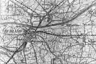
Ruhland. Karte, 1:100.000

Hohenbocka. Karte 1:100.000
Spessart-Wanderkarte, 1:100.000
Karte des Deutschen Reiches: 549 Erlangen. 1:100.000. Umdruckausgabe
Karte des Deutschen Reiches, Blatt 514 Wunsiedel. 1:100.000. Umdruckausgabe
Karte des Deutschen Reiches 1 : 100.000 (Umdruckausgabe) (Sammlung)
Bohrkarten 1:100.000
Wehrwirtschaft (1:100000)
Tunisie <1:100000>
Umgebungskarte (1:100.000)
Umgebungskarte (1:100.000)
Kleine Umgebungskarte von Hof. 1:100.000. Reichsamt für Landesaufnahme, Berlin (Herausgeber)
Ruhland. Karte, 1:100.000
Hohenbocka. Karte 1:100.000