Karte / Plan
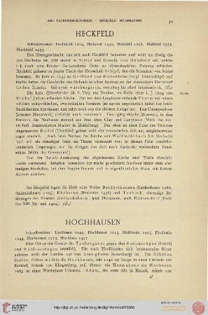
Luftbildkarte Jülich. Bildfläche: Brückenkopf –Fort Napoleon, Heckfeld – Königskamp. Inhalt: Brückenkopf, Zitadelle; Fort Napoleon; Friedhof Merscher Höhe; Ringofenziegelei; Heckfeld; Königskamp, Jägerhaus
- Reference number
-
B - Luftbildkarten, B - 36
- Dimensions
-
Blatt: 250 × 260 mm; Karte: 228 × 244 mm
- Further information
-
Ort: o. A.
Ausführung: Fotopapier auf Pappe aufgezogen
Maßstab: fehlt
Druck / Verlag: US-Luftaufklärer
- Context
-
Luftbildkarten
- Holding
-
B - Luftbildkarten Luftbildkarten
- Date of creation
-
1944 Sept. 28
- Other object pages
- Provenance
-
Jürgen E. Dominicus, Nörvenich (aus Nachlass Scheuer)
- Delivered via
- Last update
-
05.11.2025, 3:10 PM CET
Data provider
This object is provided by:
Stadtarchiv Jülich. If you have any questions about the object, please contact the data provider.
Stadtarchiv Jülich. If you have any questions about the object, please contact the data provider.
Object type
- Karten und Pläne
Time of origin
- 1944 Sept. 28
Other Objects (12)

Luftbildkarte Jülich. Bildfläche: Gut Nierstein – Merscher Höhen, Rur – Königskamp. Inhalt: Brückenkopf, Zitadelle; Gut Nierstein: Heckfeld, Kunstfäden-Fabrik; Zuckerfabrik
Wohngebiete Artilleriefahrplatz und Königskamp
Heckfeld
Heckfeld
Heckfeld
Heckfeld
⟦Heckfeld⟧
Heckfeld
Besatzungsschäden, Schadensort: Heckfeld Gesangverein Liederkranz, Heckfeld
Fortbildungsschulverband Heckfeld - Kupprichhausen (Verbandsorte: Heckfeld, Kupprichhausen)
Hollmann, Gertrud Anna. Königskamp, Hermann
Stapel geb. Königskamp, Paula Hedwig
Luftbildkarte Jülich. Bildfläche: Gut Nierstein – Merscher Höhen, Rur – Königskamp. Inhalt: Brückenkopf, Zitadelle; Gut Nierstein: Heckfeld, Kunstfäden-Fabrik; Zuckerfabrik
Wohngebiete Artilleriefahrplatz und Königskamp
Heckfeld
Heckfeld
Heckfeld
Heckfeld
⟦Heckfeld⟧
Heckfeld
Besatzungsschäden, Schadensort: Heckfeld Gesangverein Liederkranz, Heckfeld
Fortbildungsschulverband Heckfeld - Kupprichhausen (Verbandsorte: Heckfeld, Kupprichhausen)
Hollmann, Gertrud Anna. Königskamp, Hermann