- Reference number
-
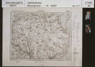
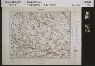
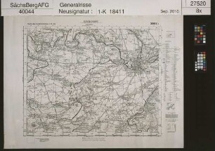
Sächsisches Staatsarchiv, 40044 Generalrisse, Nr. 1-K20201 (Zu benutzen im Bergarchiv Freiberg)
- Further information
-
Kartentype: Topografische Karte
Maßstab: 1 :25000
Umfang: Platte 3653/3 - Kreibitz, Steinschönau, Haida
Format: 76 x 99
- Context
-
40044 Generalrisse >> 1. Generalrisse >> 1.01. Topografische Karten und Übersichtskartenwerke >> 1.01.2. Ausland
- Holding
-
40044 Generalrisse
- Date of creation
-
um 1838
- Other object pages
- View digital item at providers-website
- Rights
-
Es gilt die Sächsische Archivbenutzungsverordnung vom 8. September 2022 (SächsGVBl. S. 526).
- Last update
-
21.03.2024, 8:06 AM CET
Data provider
This object is provided by:
Sächsisches Staatsarchiv. If you have any questions about the object, please contact the data provider.
Sächsisches Staatsarchiv. If you have any questions about the object, please contact the data provider.
Object type
- Karten und Pläne
Time of origin
- um 1838
Other Objects (12)

Karte des Sudetenlandes
Karte des Sudetenlandes

Karte des Sudetenlandes

Karte des Sudetenlandes

Karte des Sudetenlandes

Karte des Sudetenlandes

Karte des Sudetenlandes

Karte des Sudetenlandes

Karte des Sudetenlandes
Karte des Sudetenlandes

Karte des Sudetenlandes
Karte des Sudetenlandes
Karte des Sudetenlandes
Karte des Sudetenlandes
Karte des Sudetenlandes
Karte des Sudetenlandes
Karte des Sudetenlandes
Karte des Sudetenlandes
Karte des Sudetenlandes
Karte des Sudetenlandes
Karte des Sudetenlandes
Karte des Sudetenlandes
Karte des Sudetenlandes
Karte des Sudetenlandes
Karte des Sudetenlandes
Karte des Sudetenlandes
Karte des Sudetenlandes
Karte des Sudetenlandes
Karte des Sudetenlandes
Karte des Sudetenlandes
Karte des Sudetenlandes
Karte des Sudetenlandes
Karte des Sudetenlandes
Karte des Sudetenlandes
Karte des Sudetenlandes