Karten und Pläne
Prachatitz (Tschechoslowakei). Politische Karte des Bezirks Prachatitz
- Reference number
-
StAM, Kartensammlung 245
- Dimensions
-
54 cm x 45 cm
- Formal description
-
1 : 100 000; Farbdruck
- Language of the material
-
deutsch
- Context
-
Kartensammlung >> Kartensammlung >> 1. Kartensammlung Bd. 1-4 (retrokonvertiert)
- Holding
-
Kartensammlung
- Date of creation
-
um 1920
- Other object pages
- Last update
-
22.04.2025, 1:57 PM CEST
Data provider
This object is provided by:
Staatsarchiv München. If you have any questions about the object, please contact the data provider.
Staatsarchiv München. If you have any questions about the object, please contact the data provider.
Object type
- Karten und Pläne
Time of origin
- um 1920
Other Objects (12)

Gemeindevermisstenliste: Stadt Prachatitz; Kreis Prachatitz A-Z
Finanzamt Prachatitz
Postkarte "Prachatitz. Ringplatz"
Panoramapostkarte von Prachatitz
Panoramapostkarte von Prachatitz
Panoramapostkarte von Prachatitz
Panoramapostkarte von Prachatitz
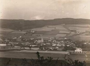
Prachatitz. Gesamtansicht. Böhmerwald
Gemeindeseelenliste: Stadt Prachtitz; Nr. 1 -2552; Kreis Prachatitz; Alt Prachatitz -Humwald
Ahorn-Stiftung, Geschäftsstelle Prachatitz
Postkarte "Prachatitz. Stadt-Thor"
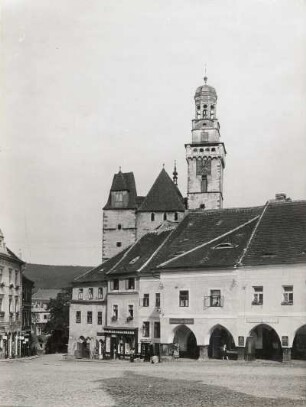
Prachatitz. Marktplatz mit Kirche
Gemeindevermisstenliste: Stadt Prachatitz; Kreis Prachatitz A-Z
Finanzamt Prachatitz
Postkarte "Prachatitz. Ringplatz"
Panoramapostkarte von Prachatitz
Panoramapostkarte von Prachatitz
Panoramapostkarte von Prachatitz
Panoramapostkarte von Prachatitz
Prachatitz. Gesamtansicht. Böhmerwald
Gemeindeseelenliste: Stadt Prachtitz; Nr. 1 -2552; Kreis Prachatitz; Alt Prachatitz -Humwald
Ahorn-Stiftung, Geschäftsstelle Prachatitz
Postkarte "Prachatitz. Stadt-Thor"