- Reference number
-
2A Karten K 1461 G/ÜF
- Context
-
Rep. 2A Regierung Potsdam - Karten >> Straßen (mit dazugehörigen Lageplänen) >> Kreise >> Kreis Ruppin
- Holding
-
2A Karten (26197) Rep. 2A Regierung Potsdam - Karten
- Date of creation
-
1852
- Other object pages
- Last update
-
07.04.2025, 11:32 AM CEST
Data provider
This object is provided by:
Brandenburgisches Landeshauptarchiv. If you have any questions about the object, please contact the data provider.
Brandenburgisches Landeshauptarchiv. If you have any questions about the object, please contact the data provider.
Object type
- Archivale
Time of origin
- 1852
Other Objects (12)
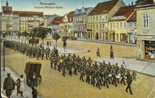
Neuruppin - Friedrich-Wilhelm-Straße
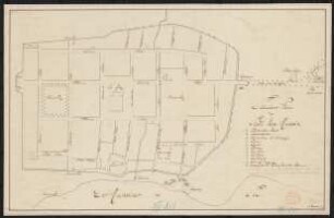
Situations-Plan der Stadt Neu-Ruppin

Situationsplan der Kaserne in Neuruppin. Blatt 1
Land- und Amtsgericht, sowie Gefängnis in Neuruppin. Situationsplan

Neuruppin, Straße : Neuruppin. Bahnhofstraße. Straßenbild
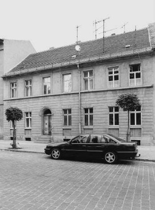
Neuruppin, Friedrich-Engels-Straße 49

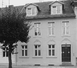
Neuruppin, Friedrich-Engels-Straße 35
Neuruppin, Friedrich-Ebert-Straße 11
Neuruppin, Friedrich-Engels-Straße 5
Neuruppin, Friedrich-Engels-Straße 24
Neuruppin, Friedrich-Ebert-Straße 6
Neuruppin, Friedrich-Engels-Straße 23
Neuruppin - Friedrich-Wilhelm-Straße
Situations-Plan der Stadt Neu-Ruppin
Situationsplan der Kaserne in Neuruppin. Blatt 1
Land- und Amtsgericht, sowie Gefängnis in Neuruppin. Situationsplan
Neuruppin, Straße : Neuruppin. Bahnhofstraße. Straßenbild
Neuruppin, Friedrich-Engels-Straße 49
Neuruppin, Friedrich-Engels-Straße 35
Neuruppin, Friedrich-Ebert-Straße 11
Neuruppin, Friedrich-Engels-Straße 5
Neuruppin, Friedrich-Engels-Straße 24
Neuruppin, Friedrich-Ebert-Straße 6