Karte / Plan
Carte itinéraire de l'Empire Franscais donnant toutes les nouvelles routes
- Reference number
-
181c
- Dimensions
-
520 x 540
- Notes
-
Pap., Or.: N, einfache ovale Titelkartusche, Verzeichnis der 110 Départements des frz. Kaiserreiches
- Further information
-
Standort: 13.05
Ausführung: Kupfertiefdruck, Départements-Grenzen bunt u. nummeriert
Maßstab: [1 : 105.000]
Anzahl: 3
Druck / Verlag: Hyacinthe Langlois libraire, Paris, Rue de Seine, faubourg Saint-Germain, Nr. 6, 1807
- Context
-
Karten und Pläne >> Überregionale Karten >> Kupferstiche
- Holding
-
S 2a Karten und Pläne Karten und Pläne
- Indexentry place
-
Frankreich
- Date of creation
-
1806
- Other object pages
- Delivered via
- Last update
-
17.09.2025, 2:36 PM CEST
Data provider
This object is provided by:
Kreisarchiv Viersen. If you have any questions about the object, please contact the data provider.
Kreisarchiv Viersen. If you have any questions about the object, please contact the data provider.
Object type
- Karten und Pläne
Time of origin
- 1806
Other Objects (12)

Carte Itinéraire de l'Empire Français donnant toutes les Nouvelles Routes 1807. Mit Schuber
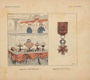
Donnant donnant

Itinéraire de la Morée : ou description des routes de cette péninsule
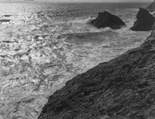
Brandung bei Port Donnant : Meeresbrandung und Küste bei Port Donnant
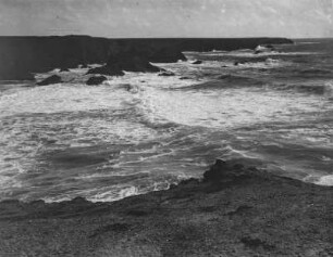
Brandung bei Port Donnant : Meeresbrandung an der Küste bei Port Donnant
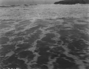
Brandung bei Port Donnant : Ankommende Brandungswellen am Strand bei Port Donnant

Carte de l'empire de Napoléon - Itinéraire des armées de Napoléon

Isaac donnant sa Bénédiction

Carte Itinéraire de La France : Indiquant Toutes les grandes Routes et les distances en lieues de Poste d'une Ville à une autre
Itineraire
Itinéraire

Itineraire
Carte Itinéraire de l'Empire Français donnant toutes les Nouvelles Routes 1807. Mit Schuber
Donnant donnant
Itinéraire de la Morée : ou description des routes de cette péninsule
Brandung bei Port Donnant : Meeresbrandung und Küste bei Port Donnant
Brandung bei Port Donnant : Meeresbrandung an der Küste bei Port Donnant
Brandung bei Port Donnant : Ankommende Brandungswellen am Strand bei Port Donnant
Carte de l'empire de Napoléon - Itinéraire des armées de Napoléon
Isaac donnant sa Bénédiction
Carte Itinéraire de La France : Indiquant Toutes les grandes Routes et les distances en lieues de Poste d'une Ville à une autre
Itineraire
Itinéraire
Itineraire
Carte Itinéraire de l'Empire Français donnant toutes les Nouvelles Routes 1807. Mit Schuber
Donnant donnant
Itinéraire de la Morée : ou description des routes de cette péninsule
Brandung bei Port Donnant : Meeresbrandung und Küste bei Port Donnant
Brandung bei Port Donnant : Meeresbrandung an der Küste bei Port Donnant
Brandung bei Port Donnant : Ankommende Brandungswellen am Strand bei Port Donnant
Carte de l'empire de Napoléon - Itinéraire des armées de Napoléon
Isaac donnant sa Bénédiction
Carte Itinéraire de La France : Indiquant Toutes les grandes Routes et les distances en lieues de Poste d'une Ville à une autre
Itineraire
Itinéraire