Die Karte von 1789
Titelzusatz: Einteilung und Entwicklung der Territorien von 1600 bis 1794
- Reference number
-
02.01.010-a.2
- Notes
-
Dublette: R 131 (Kuhtor)
- Further information
-
Verlag: Hanstein
Erscheinungsort: Bonn
Ausgabebezeichnung: Nachdruck der Ausgabe von 1898
Seiten: 789 S.
- Context
-
Teilbibliothek Viersen (alte Systematik) >> Hauptgruppe 02. Atlanten, Führer >> Gruppe 02.01 Hist. Atlanten
- Holding
-
Teilbibliothek Viersen (alte Systematik)
- Indexbegriff subject
-
Fabricius, Wilhelm
Rheinprovinz, Geographie
- Date of creation
-
1965
- Other object pages
- Delivered via
- Last update
-
05.11.2025, 3:16 PM CET
Data provider
This object is provided by:
Kreisarchiv Viersen. If you have any questions about the object, please contact the data provider.
Kreisarchiv Viersen. If you have any questions about the object, please contact the data provider.
Object type
- Sonstiges
Time of origin
- 1965
Other Objects (12)

Karte "Elsass im Jahre 1789"
Karten der Stadtvermessung: Grundstücksneuordnung (1789-1941) (Bestand)
Manual 1789, Göttingen, 1789 : 1789
Karte: Deutschland 1789 und Europa bis 1815
Karte: Deutschland 1789 und Europa bis 1815

Karte 3: Jenfeldund Umgebung 1789/ 1796 nach der Varendorf'schen Karte

1789 (alte Nr.: 474) Grünwalde, Topographische Karte 1:25000 (4cm - Karte)

1789: Württembergisches Adressbuch, 1789
Karte der Staats- und Verwaltungsgrenzen von Deutschland im Jahre 1789
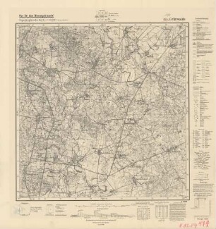
1789 (alte Nr.: 474) Grünwalde, Topographische Karte 1:25000 (4 cm - Karte)

Gazette de Bonn. 1789-1789

Gazette de Bonn. 1789-1789
Karte "Elsass im Jahre 1789"
Karten der Stadtvermessung: Grundstücksneuordnung (1789-1941) (Bestand)
Manual 1789, Göttingen, 1789 : 1789
Karte: Deutschland 1789 und Europa bis 1815
Karte: Deutschland 1789 und Europa bis 1815
Karte 3: Jenfeldund Umgebung 1789/ 1796 nach der Varendorf'schen Karte
1789 (alte Nr.: 474) Grünwalde, Topographische Karte 1:25000 (4cm - Karte)
1789: Württembergisches Adressbuch, 1789
Karte der Staats- und Verwaltungsgrenzen von Deutschland im Jahre 1789
1789 (alte Nr.: 474) Grünwalde, Topographische Karte 1:25000 (4 cm - Karte)
Gazette de Bonn. 1789-1789
Gazette de Bonn. 1789-1789
Karte "Elsass im Jahre 1789"
Karten der Stadtvermessung: Grundstücksneuordnung (1789-1941) (Bestand)
Manual 1789, Göttingen, 1789 : 1789
Karte: Deutschland 1789 und Europa bis 1815
Karte: Deutschland 1789 und Europa bis 1815
Karte 3: Jenfeldund Umgebung 1789/ 1796 nach der Varendorf'schen Karte
1789 (alte Nr.: 474) Grünwalde, Topographische Karte 1:25000 (4cm - Karte)
1789: Württembergisches Adressbuch, 1789
Karte der Staats- und Verwaltungsgrenzen von Deutschland im Jahre 1789
1789 (alte Nr.: 474) Grünwalde, Topographische Karte 1:25000 (4 cm - Karte)
Gazette de Bonn. 1789-1789