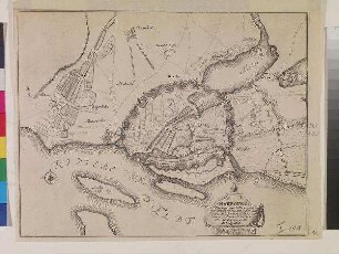
Stadtplan
Karte von Hamburg
Maßstab 1:10.000 ohne Kt-Netz Die Karte zeigt die Stadt Hamburg und ihre Festungsanlagen.
- Location
-
Schleswig-Holsteinische Landesbibliothek - Landesgeschichtliche Sammlung
- Collection
-
Karten
- Inventory number
-
I 101 2Ex
- Measurements
-
Blattmaß: Höhe: 30,5 cm; Breite: 40 cm Plattenmaß: Höhe: 22,2 cm; Breite: 29,3 cm Bildmaß: Höhe: 22,4 cm; Breite: 28,7 cm
- Material/Technique
-
Papier; Kupferstich
- Inscription/Labeling
-
Signatur: betitelt Wo: u. r. im Bild Was: Hamborg : Ville Imperiale d'Allemagne, tres fameux Port de Mer, Située a l'Entrée de la Riviere d'Elbe, a 53 Degrez 50 Minutes de Latitude et a 28 Degrez 15 Minu. de Longitude.
Signatur: bezeichnet Wo: u. r. Was: 139
- Related object and literature
-
Dokumentiert in: IKAR Landkartendrucke vor 1850.
- Classification
-
Bau- und Konstruktionszeichnungen/Baupläne (Sachgruppe)
Stadt- und Bebauungspläne (Sachgruppe)
- Subject (what)
-
Ikonographie: Stadtpläne
- Subject (where)
-
Hamburg
Altona (Bezirk)
- Delivered via
- Last update
-
29.04.2025, 11:17 AM CEST
Data provider
This object is provided by:
Schleswig-Holsteinische Landesbibliothek - Landesgeschichtliche Sammlung. If you have any questions about the object, please contact the data provider.
Schleswig-Holsteinische Landesbibliothek - Landesgeschichtliche Sammlung. If you have any questions about the object, please contact the data provider.
Object type
- Stadtplan
Associated
Time of origin
- 1730
Other Objects (12)
Karte von Hamburg
Monachium Vulgo Munchen Electoris Bavariae : Sedes Aulica et Metropolis ; Avec privilege

Cercle Electoral Du Rhin : Suivant les Nouvelles Observations de Messrs. de l'Academie Royale des Sciences, etc. ; Augmentées de Nouveau
Cercle Electoral Du Rhin : Suivant les Nouvelles Observations de Messrs. de l'Academie Royale des Sciences, etc. ; Augmentées de Nouveau

Prochiron sive Enchiridion iudiciarium
L'Archeveché De Cologne : Suivant les Nouvelles Observations de Messrs. de l'Academie Royale des Sciences, etc. ; Augmentées de Nouveau
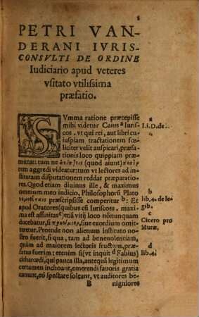
Prochiron sive Enchiridion iudiciarium
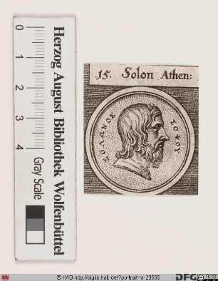
Bildnis Solon von Athen
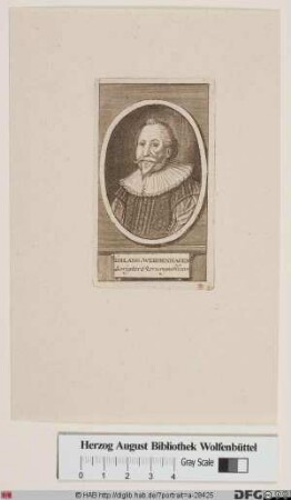
Bildnis Johann Angelius (von) Werdenhagen
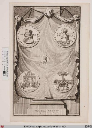
Bildnis Desiderius Erasmus, gen. Erasmus von Rotterdam
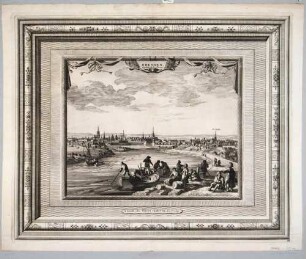
Stadtansicht von Dresden, Blick von Osten über die Elbe auf Altstadt und Neustadt, im Vordergrund Boote und Staffagefiguren
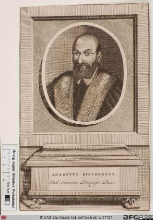
Bildnis Antonio Riccoboni
Karte von Hamburg
Monachium Vulgo Munchen Electoris Bavariae : Sedes Aulica et Metropolis ; Avec privilege
Cercle Electoral Du Rhin : Suivant les Nouvelles Observations de Messrs. de l'Academie Royale des Sciences, etc. ; Augmentées de Nouveau
Cercle Electoral Du Rhin : Suivant les Nouvelles Observations de Messrs. de l'Academie Royale des Sciences, etc. ; Augmentées de Nouveau
Prochiron sive Enchiridion iudiciarium
L'Archeveché De Cologne : Suivant les Nouvelles Observations de Messrs. de l'Academie Royale des Sciences, etc. ; Augmentées de Nouveau
Prochiron sive Enchiridion iudiciarium
Bildnis Solon von Athen
Bildnis Johann Angelius (von) Werdenhagen
Bildnis Desiderius Erasmus, gen. Erasmus von Rotterdam
Stadtansicht von Dresden, Blick von Osten über die Elbe auf Altstadt und Neustadt, im Vordergrund Boote und Staffagefiguren