Grafik | Landkarte
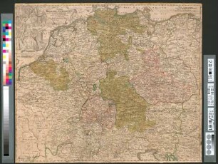
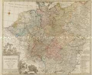
Imperii Romano-Germanici in suos status et circulos divisi tabula generalis
Historische Landkarte des heiligen Römischen ReichesDeutscher Nation mit Titelkartusche oben links mit Kaiser und Thron.
- Alternative title
-
L'Allemagne. In usus iuventutis erudiendae accomodata
- Collection
-
Pictothek
- Identifier
-
36/A 1.23
- Source
-
Universitätsbibliothek Würzburg
- Extent
-
520 mm x 440 mm
- Language
-
Latein
Französisch
- Subject
-
Altkarte
- Subject (where)
-
Deutschland
- URN
-
urn:nbn:de:bvb:20-36a123term73544249-4
- Last update
-
06.03.2025, 3:26 PM CET
Data provider
This object is provided by:
Universitätsbibliothek Würzburg. If you have any questions about the object, please contact the data provider.
Universitätsbibliothek Würzburg. If you have any questions about the object, please contact the data provider.
Object type
- Grafik
- Landkarte
Associated
Time of origin
- Ca. 1720
Other Objects (12)

Imperii Romano-Germanici in suos status et circulos divisi
Imperii Romano-Germanici In Suos Status Et Circulos Divisi Tabula Generalis

Imperii Romano-germanici in suos status et circulos divisi. Tabula generalis in usus iuventutis erudiendae
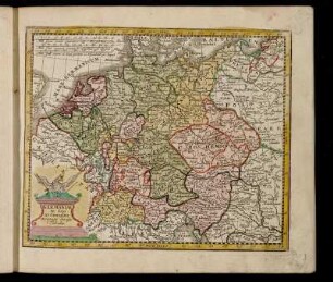
![Imperii Romano-Germanici in Suos status et Circulos Divisi Tabula Generalis in UsusIuvenatis erudiendie accommodata [Atlas Germaniae specialis (Atlas Maior II), 1753]](https://iiif.deutsche-digitale-bibliothek.de/image/2/511f63ea-1fe4-49b7-9290-2efc45dfdd5a/full/!306,450/0/default.jpg)
Imperii Romano-Germanici in Suos status et Circulos Divisi Tabula Generalis in UsusIuvenatis erudiendie accommodata [Atlas Germaniae specialis (Atlas Maior II), 1753]
De S. Imperii Romano-Germanici Divisione In Decem Circulos
De S. Imperii Romano-Germanici Divisione In Decem Circulos

Mappa generalis Gubernii Asowiensis in Circulos divisi
"Imperium Romano - Germanicum in suos circulos divisum"
Germaniae in suos XI. Circulos accurato divisæ Tabula.
GERMANIA secundum observationes recentissimas in suos circulos divisa
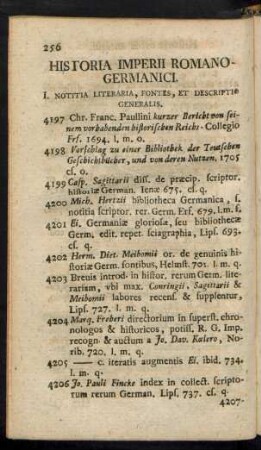
Historia Imperii Romano-Germanici
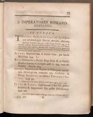
3) Imperatores Romano-Germanici.
Imperii Romano-Germanici in suos status et circulos divisi
Imperii Romano-Germanici In Suos Status Et Circulos Divisi Tabula Generalis
Imperii Romano-germanici in suos status et circulos divisi. Tabula generalis in usus iuventutis erudiendae
Imperii Romano-Germanici in Suos status et Circulos Divisi Tabula Generalis in UsusIuvenatis erudiendie accommodata [Atlas Germaniae specialis (Atlas Maior II), 1753]
De S. Imperii Romano-Germanici Divisione In Decem Circulos
De S. Imperii Romano-Germanici Divisione In Decem Circulos
Mappa generalis Gubernii Asowiensis in Circulos divisi
"Imperium Romano - Germanicum in suos circulos divisum"
Germaniae in suos XI. Circulos accurato divisæ Tabula.
GERMANIA secundum observationes recentissimas in suos circulos divisa
Historia Imperii Romano-Germanici