Karten und Pläne
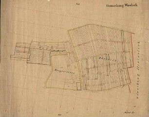
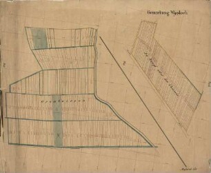
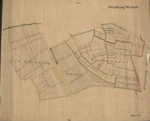
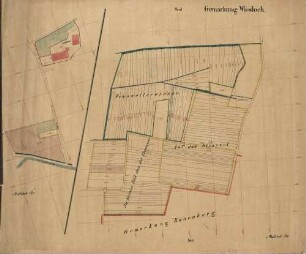
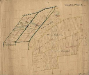
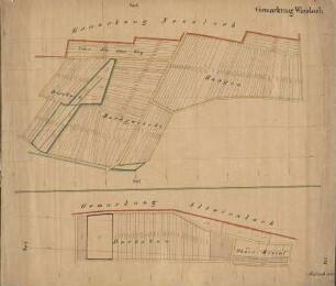
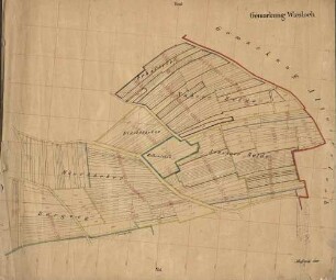
Gemarkung Wiesloch
Katasterplan. Vier Fluren ("Rechts der alten Bruchsalerstraße, Im äussern Sumpf, Links der alten Bruchsalerstraße, Aeussere Rohrlach"), unterteilt in durchnummerierte Parzellen. Wege eingezeichnet. Vermessungslinien.
- Reference number
-
Abt. Generallandesarchiv Karlsruhe, H Wiesloch 6
- Dimensions
-
58 x 71,5 (Höhe x Breite)
- Notes
-
auf Leinen
- Further information
-
Ausführung: Handzeichnung
Orientierung: W
Originalmaßstab: 1:1 500
- Context
-
Gemarkungspläne >> Badische Orte >> W >> Wiesloch, Stadt, HD
- Holding
-
Landesarchiv Baden-Württemberg, Abt. Generallandesarchiv Karlsruhe, H Gemarkungspläne
- Creator
-
Autor/Fotograf: ?
- Date of creation
-
2. Hälfte 19. Jh.
- Other object pages
- View digital item at providers-website
- Rights
-
Es gelten die Nutzungsbedingungen des Landesarchivs Baden-Württemberg.
- Last update
- 04.04.2025, 8:04 AM CEST
Data provider
This object is provided by:
Landesarchiv Baden-Württemberg. If you have any questions about the object, please contact the data provider.
Landesarchiv Baden-Württemberg. If you have any questions about the object, please contact the data provider.
Object type
- Karten und Pläne
Associated
- Autor/Fotograf: ?
Time of origin
- 2. Hälfte 19. Jh.
Other Objects (12)

Gemeindewald Wiesloch Gemarkung Wiesloch Plan
Gemeindewald Wiesloch Gemarkung Wiesloch Plan
Gemarkung Wiesloch
Gemarkung Wiesloch
Gemarkung Wiesloch
Gemarkung Wiesloch
Gemarkung Wiesloch
Gemarkung Wiesloch
Gemarkung Wiesloch
Flurkarte Gemarkung Wiesloch
Flurkarte Gemarkung Wiesloch
Flurkarte Gemarkung Wiesloch
Gemeindewald Wiesloch Gemarkung Wiesloch Plan
Gemeindewald Wiesloch Gemarkung Wiesloch Plan
Gemarkung Wiesloch
Gemarkung Wiesloch
Gemarkung Wiesloch
Gemarkung Wiesloch
Gemarkung Wiesloch
Gemarkung Wiesloch
Gemarkung Wiesloch
Flurkarte Gemarkung Wiesloch
Flurkarte Gemarkung Wiesloch
Flurkarte Gemarkung Wiesloch
Gemeindewald Wiesloch Gemarkung Wiesloch Plan
Gemeindewald Wiesloch Gemarkung Wiesloch Plan
Gemarkung Wiesloch
Gemarkung Wiesloch
Gemarkung Wiesloch
Gemarkung Wiesloch
Gemarkung Wiesloch
Gemarkung Wiesloch
Gemarkung Wiesloch
Flurkarte Gemarkung Wiesloch
Flurkarte Gemarkung Wiesloch