Karte / Plan
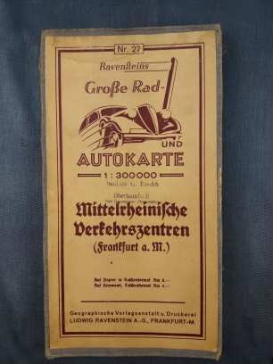
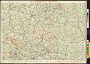
Westfalen Rad- und Autokarte um 1938 1 : 300 000 67 x 81 farb. Druck: Ravensteins Geographische Verlagsanstalt
- Reference number
-
W 051, 28622
- Further information
-
Ort: Westfalen
- Context
-
Karten A (Allgemein) >> 5. Verkehr >> 5.2. Straßen / Straßenbau >> 5.2.2. L-Z
- Holding
-
W 051 Karten A (Allgemein)
- Indexbegriff subject
-
Autokarte, Westfalen, 1938
Rad- und Autokarte, Westfalen, 1938
- Indexentry place
-
Westfalen
Westfalen, Rad- und Autokarte, 1938
- Date of creation
-
1938
- Other object pages
- Provenance
-
Sammlungsregistraturbildner
- Delivered via
- Last update
-
05.11.2025, 3:29 PM CET
Data provider
This object is provided by:
Landesarchiv Nordrhein-Westfalen. Abteilung Westfalen. If you have any questions about the object, please contact the data provider.
Landesarchiv Nordrhein-Westfalen. Abteilung Westfalen. If you have any questions about the object, please contact the data provider.
Object type
- Karten / Pläne
Time of origin
- 1938
Other Objects (12)

Ravensteins Rad- und Autokarte Nr. 40 : Moselgebiet
Ravensteins Rad- und Autokarte Nr. 23 : Bremen
Koblenz -Ravensteins Rad- und Autokarte Nr. 25
Ravensteins Große Rad- und Autokarte 1 : 300.000
Ravensteins große Rad- und Autokarte Posen - Litzmannstadt
Ravensteins Rad- und Autokarte Nr. 8 : Hessen-Nassau
Ravensteins Rad- und Autokarte der Regierungsbezirke Oberfranken und Oberpfalz
Ravensteins Rad- und Autokarte Nr. 32 : Köln-Düsseldorf-Aachen
Ravensteins Rad- und Autokarte Nr. 71 Ostalpen 1:500.000
Ravensteins Rad- und Autokarte Nr. 1 : Badisch-Württembergische Verkehrszentren
Ravensteins Rad- und Autokarte Nr. 66. Rheinisch-Westfälisches Industriegebiet
Köln-Düsseldorf-Aachen -Ravensteins Große Rad- und Autokarte Nr. 32
Ravensteins Rad- und Autokarte Nr. 40 : Moselgebiet
Ravensteins Rad- und Autokarte Nr. 23 : Bremen
Koblenz -Ravensteins Rad- und Autokarte Nr. 25
Ravensteins Große Rad- und Autokarte 1 : 300.000
Ravensteins große Rad- und Autokarte Posen - Litzmannstadt
Ravensteins Rad- und Autokarte Nr. 8 : Hessen-Nassau
Ravensteins Rad- und Autokarte der Regierungsbezirke Oberfranken und Oberpfalz
Ravensteins Rad- und Autokarte Nr. 32 : Köln-Düsseldorf-Aachen
Ravensteins Rad- und Autokarte Nr. 71 Ostalpen 1:500.000
Ravensteins Rad- und Autokarte Nr. 1 : Badisch-Württembergische Verkehrszentren
Ravensteins Rad- und Autokarte Nr. 66. Rheinisch-Westfälisches Industriegebiet