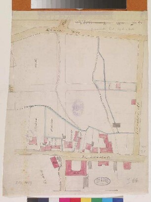
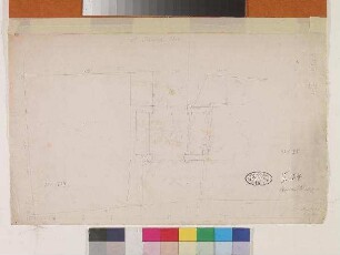
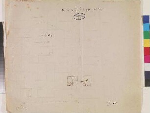
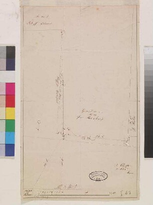
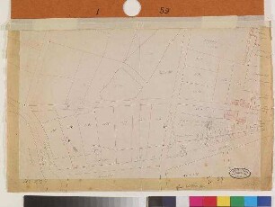
Plan
Grundstück der Universität zu Kiel.
Maßstab 1:1.500 Maßstab in geogr. Form (Meter) ohne Kt-Netz Die Karte zeigt die Grundstücke die zum Besitz der Universität gehören, sowie eine geplante Straße.
- Standort
-
Schleswig-Holsteinische Landesbibliothek - Landesgeschichtliche Sammlung
- Sammlung
-
Karten
- Inventarnummer
-
I 56
- Maße
-
Blattmaß: Höhe: 29 cm; Breite: 41,8 cm Bildmaß: Höhe: 21 cm; Breite: 34 cm
- Material/Technik
-
Papier; Lithographie (koloriert)
- Inschrift/Beschriftung
-
Signatur: betitelt Wo: o. l. Was: Grundstück der Universität zu Kiel.
Signatur: bezeichnet Wo: u. r. Was: Kiel, d. 11. April 1876. H. Speck.
- Klassifikation
-
Katasterkarten (Sachgruppe)
- Bezug (was)
-
Ikonographie: Stadtpläne
Ikonographie: Universität
- Bezug (wo)
-
Kiel
- Ereignis
-
Herstellung
- (wer)
-
Speck, H. (Hersteller)
- (wann)
-
1876
- Geliefert über
- Letzte Aktualisierung
-
29.04.2025, 11:17 MESZ
Datenpartner
Dieses Objekt wird bereitgestellt von:
Schleswig-Holsteinische Landesbibliothek - Landesgeschichtliche Sammlung. Bei Fragen zum Objekt wenden Sie sich bitte an den Datenpartner.
Schleswig-Holsteinische Landesbibliothek - Landesgeschichtliche Sammlung. Bei Fragen zum Objekt wenden Sie sich bitte an den Datenpartner.
Objekttyp
- Plan
Beteiligte
- Speck, H. (Hersteller)
Entstanden
- 1876
Ähnliche Objekte (12)
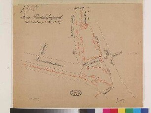
Grundstücke, Kiel, Sophienblatt.
Karte von der Universität zu Kiel
Grundstück Alter Bahnhof, Kiel
Karte von Grundstücken in Kiel
Grundstück in Kiel, Flämisches Thos.
Karte von Grundstücken in Kiel
Karte von einem Grundstück in Kiel
Karte von einem Grundstück in Kiel
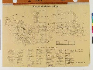
Kaiserliche Werft zu Kiel
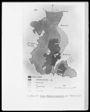
Bebauungsplan von Kiel
Karte von Kiel
Karte vom Bootshafen, Kiel
Grundstücke, Kiel, Sophienblatt.
Karte von der Universität zu Kiel
Grundstück Alter Bahnhof, Kiel
Karte von Grundstücken in Kiel
Grundstück in Kiel, Flämisches Thos.
Karte von Grundstücken in Kiel
Karte von einem Grundstück in Kiel
Karte von einem Grundstück in Kiel
Kaiserliche Werft zu Kiel
Bebauungsplan von Kiel
Karte von Kiel