Küstenkarte
Plano de la Isla y Puerto de Santa Catalina. Mit einer Ansicht: Vista de la Isla de Sta. Catalina por la parte del Este
- Alternative title
-
Plano de la Isla / y Puerto de / Santa Catalina / situado en la America Meridional
- Location
-
Deutsches Historisches Museum, Berlin
- Inventory number
-
Do 2006/1159
- Measurements
-
Höhe x Breite: 48,6 x 61,5 cm (Blatt)
Höhe x Breite: 27 x 35,6 cm (Karte)
Höhe x Breite: 40,5 x 43,6 cm (Platte)
- Material/Technique
-
Papier, Kupferstich, koloriert
- Classification
-
Kartografie (Gattung)
- Subject (what)
-
Santa Catarina
Brasilien
- Event
-
Herstellung
- (who)
-
Stecher, Geograph, Verleger: Tomás Lopéz y Vargas Machuca
- (where)
-
Madrid, Spanien
- (when)
-
1777
- Rights
-
Deutsches Historisches Museum
- Last update
-
24.03.2023, 9:28 AM CET
Data provider
This object is provided by:
Stiftung Deutsches Historisches Museum. If you have any questions about the object, please contact the data provider.
Stiftung Deutsches Historisches Museum. If you have any questions about the object, please contact the data provider.
Object type
- Küstenkarte
Associated
- Stecher, Geograph, Verleger: Tomás Lopéz y Vargas Machuca
Time of origin
- 1777
Other Objects (12)
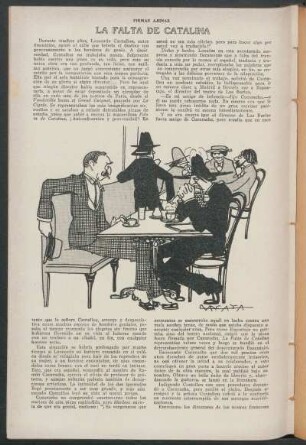
La falta de Catalina

Varias Relaciones del Perú y Chile y conquista de la isla de Santa Catalina 1535 á 1658

No. 49. Plano del Fondeadero de la Isla Bancungan

No. 50. Plano del Fondeadero de la Isla Capual

No. 29. Plano de la Bahia Dalauan en la Isla de Balábac
Los amores de Catalina la Grande
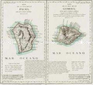
Mapa de la Isla de la Palma / Mapa de la Isla de la Gomera

Catalina la grande
Catalina la Grande

Plano del recinto de la exposicion general de las Islas Filipinas
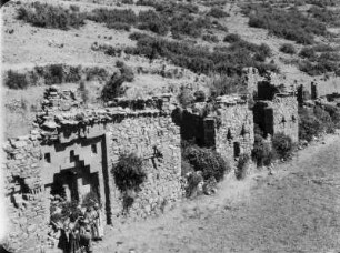
Isla de la Sol : Ruinen auf der Isla de la Sol.
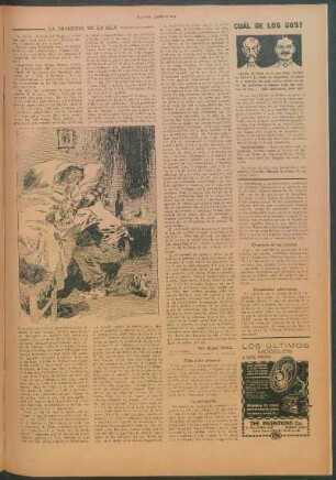
La tragedia de la isla
La falta de Catalina
Varias Relaciones del Perú y Chile y conquista de la isla de Santa Catalina 1535 á 1658
No. 49. Plano del Fondeadero de la Isla Bancungan
No. 50. Plano del Fondeadero de la Isla Capual
No. 29. Plano de la Bahia Dalauan en la Isla de Balábac
Los amores de Catalina la Grande
Mapa de la Isla de la Palma / Mapa de la Isla de la Gomera
Catalina la grande
Catalina la Grande
Plano del recinto de la exposicion general de las Islas Filipinas
Isla de la Sol : Ruinen auf der Isla de la Sol.