Karten und Pläne
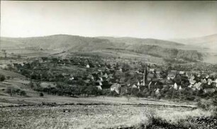
Jettenbach (LK Mühldorf). Karte des herrschaftlichen Forstreviers Jettenbach 1840
- Reference number
-
StAM, Kartensammlung 1802
- Dimensions
-
49 cm x 41 cm
- Formal description
-
1 : 10 000; Lithographie koloriert
- Language of the material
-
deutsch
- Further information
-
Urheber: Stecher: Joh. Obermetter
- Context
-
Kartensammlung >> Kartensammlung >> 1. Kartensammlung Bd. 1-4 (retrokonvertiert)
- Holding
-
Kartensammlung
- Date of creation
-
1840
- Other object pages
- Last update
-
22.04.2025, 1:53 PM CEST
Data provider
This object is provided by:
Staatsarchiv München. If you have any questions about the object, please contact the data provider.
Staatsarchiv München. If you have any questions about the object, please contact the data provider.
Object type
- Karten und Pläne
Time of origin
- 1840
Other Objects (12)

Landrat Mühldorf, Bieraufschlag, Jettenbach
Jettenbach, Karte des herrschaftlichen Forstreviers
Jettenbach:
Töwing-Jettenbach
Jettenbach (Bestand)
Jettenbach (ev.)
Jettenbach: Häusersteuerkataster
Jettenbach - Postbotendienst
Jettenbach - Station
Jettenbach - Bezüge
Jettenbach - Personal
Jettenbach - Hilfsboten
Landrat Mühldorf, Bieraufschlag, Jettenbach
Jettenbach, Karte des herrschaftlichen Forstreviers
Jettenbach:
Töwing-Jettenbach
Jettenbach (Bestand)
Jettenbach (ev.)
Jettenbach: Häusersteuerkataster
Jettenbach - Postbotendienst
Jettenbach - Station
Jettenbach - Bezüge
Jettenbach - Personal