Karte / Plan
Brouillonkarte vom Weserufer längs der fürstl.-lipp. Landesgrenze bei Erder
- Reference number
-
D 73, 4/6177
- Dimensions
-
Höhe: 54, Breite: 147, Maßstab: 1:5.000
- Context
-
Allgemeine Kartensammlung (bisherige Kartei) >> 22. Tit. 4 (noch nicht klassifiziert) >> 22.15. Nr. 6001 - 6200
- Holding
-
D 73 Allgemeine Kartensammlung (bisherige Kartei)
- Date of creation
-
1859
- Other object pages
- Provenance
-
Behörden, Institutionen, Einzelpersonen (Sammlungen)
- Delivered via
- Last update
-
17.09.2025, 2:48 PM CEST
Data provider
This object is provided by:
Landesarchiv Nordrhein-Westfalen. Abteilung Ostwestfalen-Lippe. If you have any questions about the object, please contact the data provider.
Landesarchiv Nordrhein-Westfalen. Abteilung Ostwestfalen-Lippe. If you have any questions about the object, please contact the data provider.
Object type
- Karten / Pläne
Time of origin
- 1859
Other Objects (12)
Weser-Ufer

Instandhaltung der Weserufer
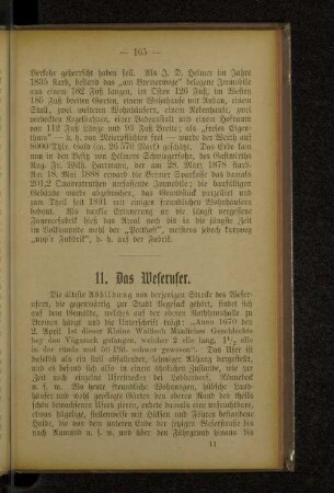
11. Das Weserufer.
Landesgrenze längs des Kreises Halberstadt
Landesgrenze längs des Kreises Wanzleben
Landesgrenze längs des Kreises Wernigerode
Landesgrenze längs des Kreises Quedlinburg
Landesgrenze längs des Kreises Haldensleben
Landesgrenze längs des Kreises Oschersleben
Landesgrenze längs des Kreises Oschersleben
Weserbrücken und Weserufer (Bestand)
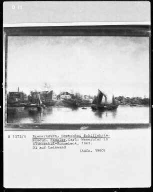
Weserufer in Blumenthal-Ronnebeck
Weser-Ufer
Instandhaltung der Weserufer
11. Das Weserufer.
Landesgrenze längs des Kreises Halberstadt
Landesgrenze längs des Kreises Wanzleben
Landesgrenze längs des Kreises Wernigerode
Landesgrenze längs des Kreises Quedlinburg
Landesgrenze längs des Kreises Haldensleben
Landesgrenze längs des Kreises Oschersleben
Landesgrenze längs des Kreises Oschersleben
Weserbrücken und Weserufer (Bestand)