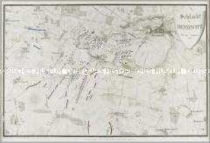
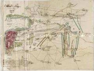
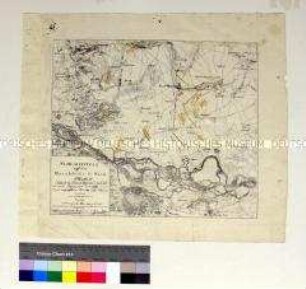
Schlachtenkarte
Karte zu den Schlachten der Befreiungskriege 1813 mit Darstellungen der Schlachtverläufe
- Location
-
Deutsches Historisches Museum, Berlin
- Inventory number
-
Do1 DHM/12
- Measurements
-
Höhe x Breite: 65 x 79,5 cm (Blatt)
- Material/Technique
-
Druckfarbe (mehrfarbig), Papier, Kupferstich, gedruckt, altkoloriert
- Classification
-
Kartografie (Gattung)
- Subject (what)
-
Krieg
Festung
Militär
Heer
- Event
-
Herstellung
- (who)
-
Stecher: Carl Mare
- (where)
-
Berlin, Deutschland [historisch: Preußen, Königreich]
- (when)
-
nach 1820
- Rights
-
Deutsches Historisches Museum
- Last update
-
24.03.2023, 9:29 AM CET
Data provider
This object is provided by:
Stiftung Deutsches Historisches Museum. If you have any questions about the object, please contact the data provider.
Stiftung Deutsches Historisches Museum. If you have any questions about the object, please contact the data provider.
Object type
- Schlachtenkarte
Associated
- Stecher: Carl Mare
Time of origin
- nach 1820
Other Objects (12)

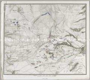
Karte zu den Schlachten der Befreiungskriege 1814-1815
Schlacht bei Dennewitz den 6ten September 1813
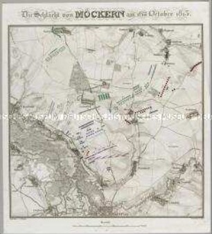
Die Schlacht von Möckern am 16ten October 1813
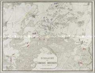
Schlacht bei Gross Beeren den 23ten August 1813
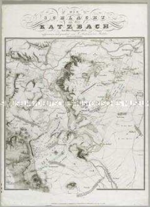
Die Schlacht an der Katzbach den 26ten August 1813

Plan der Schlacht von Gr. Goerschen den 2ten May 1813
Schlacht bei Prag
Treffen bei Hagelsberg den 27ten August 1813
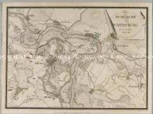
Schlacht bei Wartenburg den 3ten October MDCCCXIII
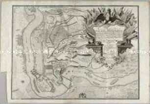
Accurater Abriss und Ordre der Schlacht bei Peterwardein
Karte zur Schlacht von Wagram auf dem Marchfeld bei Wien 1809
Plan der Schlacht bey La belle Alliance am 18ten Juni 1815
Karte zu den Schlachten der Befreiungskriege 1814-1815
Schlacht bei Dennewitz den 6ten September 1813
Die Schlacht von Möckern am 16ten October 1813
Schlacht bei Gross Beeren den 23ten August 1813
Die Schlacht an der Katzbach den 26ten August 1813
Plan der Schlacht von Gr. Goerschen den 2ten May 1813
Schlacht bei Prag
Treffen bei Hagelsberg den 27ten August 1813
Schlacht bei Wartenburg den 3ten October MDCCCXIII
Accurater Abriss und Ordre der Schlacht bei Peterwardein
Karte zur Schlacht von Wagram auf dem Marchfeld bei Wien 1809