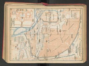
Regionalkarte
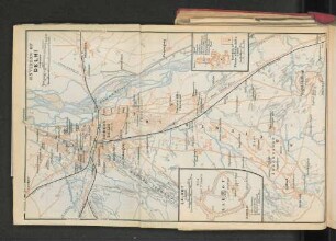
A Map of the Provinces of Delhi, Agrah, Oude, and Ellahabad, comprehending the Countries lying between Delhi, and the Bengal-Provinces
- Alternative title
-
A MAP / of the PROVINCES of / Delhi, Agrah, Oude, and Ellahabad, / comprehending the COUNTRIES lying between
- Location
-
Deutsches Historisches Museum, Berlin
- Inventory number
-
Do 2006/271
- Measurements
-
Höhe x Breite: 77,2 x 57,5 cm (Blatt 1)
Höhe x Breite: 53,2 x 52,5 cm (Karte 1)
Höhe x Breite: 56,2 x 55,2 cm (Platte 1)
Höhe x Breite: 78,4 x 62,1 cm (Blatt 2)
Höhe x Breite: 53,2 x 52,2 cm (Karte 2)
Höhe x Breite: 56,5 x 55,2 cm (Platte 2)
Höhe x Breite: 77,6 x 58,2 cm (Blatt 3)
Höhe x Breite: 52,8 x 52,5 cm (Karte 3)
Höhe x Breite: 56,3 x 55,2 cm (Platte 3)
Höhe x Breite: 77,5 x 58 cm (Blatt 4)
Höhe x Breite: 53 x 52,2 cm (Karte 4)
Höhe x Breite: 56,2 x 55,5 cm (Platte 4)
- Material/Technique
-
Druckfarbe, Papier, Kupferstich, grenzkoloriert
- Classification
-
Kartografie (Gattung)
- Subject (what)
-
Südasien
Indien
- Event
-
Herstellung
- (who)
-
Verleger, Landvermesser, Stecher: Andrew Dury
Stecher: William Haydon
Kartograf, Ozeanograph: James Rennell
- (where)
-
London, Großbritannien und Nordirland
- (when)
-
1777
- Rights
-
Deutsches Historisches Museum
- Last update
-
24.03.2023, 9:28 AM CET
Data provider
This object is provided by:
Stiftung Deutsches Historisches Museum. If you have any questions about the object, please contact the data provider.
Stiftung Deutsches Historisches Museum. If you have any questions about the object, please contact the data provider.
Object type
- Regionalkarte
Associated
- Verleger, Landvermesser, Stecher: Andrew Dury
- Stecher: William Haydon
- Kartograf, Ozeanograph: James Rennell
Time of origin
- 1777
Other Objects (12)

The Delhi Durbar.
The New Delhi.

Delhi, Delhi 1958: The National Printing Works (Druck)
Article (in 'The Delhi Hindusthan Standard') : ''Delhi Varsity Exhibition.''

Delhi’s Disempowerment
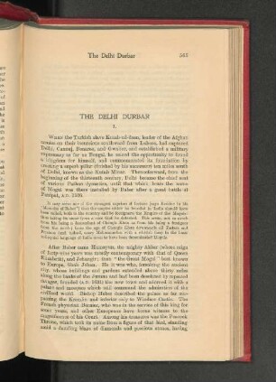
The Delhi Durbar. I.
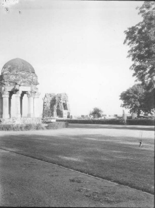
Delhi. Alt-Delhi. Hauz Khas
Delhi
Delhi
Delhi
Delhi
Delhi
The Delhi Durbar.
The New Delhi.
Delhi, Delhi 1958: The National Printing Works (Druck)
Article (in 'The Delhi Hindusthan Standard') : ''Delhi Varsity Exhibition.''
Delhi’s Disempowerment
The Delhi Durbar. I.
Delhi. Alt-Delhi. Hauz Khas
Delhi
Delhi
Delhi
Delhi
Delhi
The Delhi Durbar.
The New Delhi.
Delhi, Delhi 1958: The National Printing Works (Druck)
Article (in 'The Delhi Hindusthan Standard') : ''Delhi Varsity Exhibition.''
Delhi’s Disempowerment
The Delhi Durbar. I.
Delhi. Alt-Delhi. Hauz Khas
Delhi
Delhi
Delhi
Delhi