Graphik
Landkarte des: Empire of Japan/Kaiserreich Japan
Der die Landkarte von Japan darstellende alt-kolorierte Kupferstich stammt von dem in London vormals ansässigen Manuel Bowen (1714 bis 1767)
Im oberen linken Feld ist folgender Text vermerkt:
"A New and Accurate Map of the EMPIRE of JAPAN
Laid down from the Memoirs of the Portuguese und Dutch and particularly from the Jesuit Missionaries as published by the Sr. Bellin at Paris
Being adjusted by Astronomical Observa(n)t.
By Eman Bowen"
Objekttyp: Original
- Location
-
Kunstpalast, Düsseldorf, Düsseldorf, Nordrhein-Westfalen, Deutschland, Europe
- Inventory number
-
mkp.P 2005-1079
- Measurements
-
H 25, B 43 cm
- Material/Technique
-
Alt-kolorierter Kupferstich auf Papier
- Classification
-
Druckgrafik (Sachgruppe)
- Event
-
Herstellung
- (who)
- (where)
-
London
- (when)
-
Wohl 2. Hälfte 18. Jahrhundert
- Delivered via
- Last update
-
05.03.2025, 4:20 PM CET
Data provider
This object is provided by:
Kunstpalast. If you have any questions about the object, please contact the data provider.
Kunstpalast. If you have any questions about the object, please contact the data provider.
Object type
- Graphik
Associated
Time of origin
- Wohl 2. Hälfte 18. Jahrhundert
Other Objects (12)

Erste Eintrittskarte ins Goethehaus 1864
Lithographie mit Angelszene
Lithographien nach Kunstwerken der Sammlung Boisserée
Maroqinleder- Einband
Porträt von König Ludwig II. von Bayern,
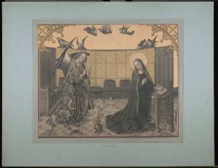
Lithographien nach Kunstwerken der Sammlung Boisserée
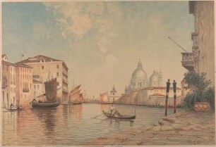
Lithographie mit Darstellung des Canal Grande in Venedig

Phantastische Nacht

Gebetbuch für alle Gelegenheiten aus dem Jahr 1729
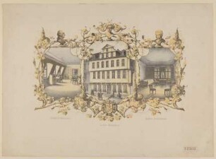
Goethe-Haus
Amors Nachtbesuch bei Anakreon
Darstellung der Circe
Erste Eintrittskarte ins Goethehaus 1864
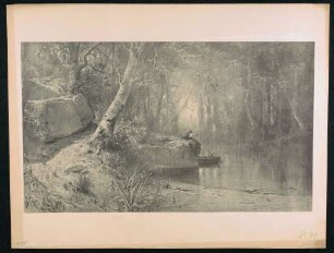
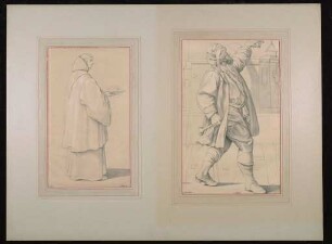
Lithographie mit Angelszene
Lithographien nach Kunstwerken der Sammlung Boisserée
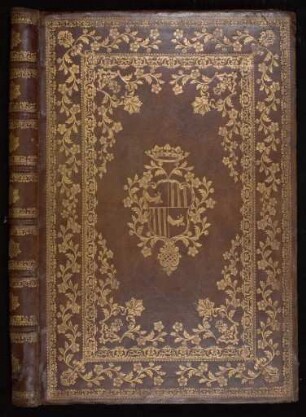
Maroqinleder- Einband
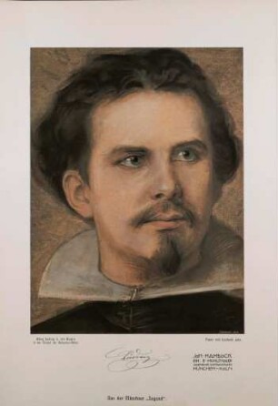
Porträt von König Ludwig II. von Bayern,
Lithographien nach Kunstwerken der Sammlung Boisserée
Lithographie mit Darstellung des Canal Grande in Venedig
Phantastische Nacht
Gebetbuch für alle Gelegenheiten aus dem Jahr 1729
Goethe-Haus
Amors Nachtbesuch bei Anakreon
Darstellung der Circe
Erste Eintrittskarte ins Goethehaus 1864
Lithographie mit Angelszene
Lithographien nach Kunstwerken der Sammlung Boisserée
Maroqinleder- Einband
Porträt von König Ludwig II. von Bayern,
Lithographien nach Kunstwerken der Sammlung Boisserée
Lithographie mit Darstellung des Canal Grande in Venedig
Phantastische Nacht
Gebetbuch für alle Gelegenheiten aus dem Jahr 1729
Goethe-Haus
Amors Nachtbesuch bei Anakreon