Verzeichnung
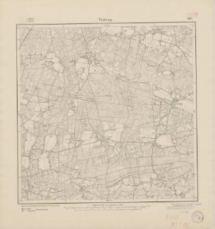
Historische Landnutzung: Blatt Vestrup TK 3214; erarbeitet auf der Grundlage historischer Karten von Dr. Fischer und U. Ostmann Maßstab: 1:25.000 Farbdruck, Nieders. Landesamt für Bodenforschung
- Reference number
-
NLA OL, K-ZE, Best. 298 Z Nr. 3847
- Further information
-
Index-Gruppe: Institution: Nieders. Landeamt für Bodenforschung
- Context
-
Zentraler Kartenbestand Oldenburg >> 5 Bezirksregierung Weser-Ems >> 5.13 Landkreis Vechta >> 5.13.3 Größere Gebietsteile >> 5.13.3.1 Gemeinde Bakum
- Holding
-
NLA OL, K-ZE Zentraler Kartenbestand Oldenburg
- Indexbegriff subject
-
Historische Landnutzung, Vestrup
- Indexentry person
-
Fischer, Dr., Kartograf
Ostmann, U., Kartograf
- Indexentry place
-
Vestrup, historische Landnutzung
- Date of creation
-
2003
- Other object pages
- Last update
-
16.06.2025, 11:08 AM CEST
Data provider
This object is provided by:
Niedersächsisches Landesarchiv. If you have any questions about the object, please contact the data provider.
Niedersächsisches Landesarchiv. If you have any questions about the object, please contact the data provider.
Object type
- Verzeichnung
Time of origin
- 2003
Other Objects (12)

3214 Vestrup
Blatt 1661 Vestrup, neu: 3214
3214 (alte Nr.: 1661) Vestrup
Blatt 1661 Vestrup, neu: 3214
Blatt 1661 Vestrup, neu: 3214
Vestrup
Raumordnungskataster topografische Karte, 3214 Vestrup, Landschaftsschutzgebiete, Erdgasleitungen, Trinkwasserleitung, Flurbereinigung, Flächennutzungspläne, Richtfunkverbindungen Maßstab: 1:25.000 Hrsg.: Niedersächsisches Landesverwaltungsamt
3214
Historische Landnutzung im UNESCO-Biosphärenreservat Rhön : Thüringer Teil
Historische Landnutzung: Blatt Vechta TK 3215; erarbeitet auf der Grundlage historischer Karten von Dr. Fischer und U. Ostmann Maßstab: 1:25.000 Farbdruck, Nieders. Landesamt für Bodenforschung
Historische Landnutzung: Blatt Essen TK 3213; erarbeitet auf der Grundlage historischer Karten von Dr. Fischer und U. Ostmann Maßstab: 1:25.000 Farbdruck, Nieders. Landesamt für Bodenforschung
Historische Landnutzung: Blatt Cloppenburg TK 3114; erarbeitet auf der Grundlage historischer Karten von Dr. Fischer und U. Ostmann Maßstab: 1:25.000 Farbdruck, Nieders. Landesamt für Bodenforschung
3214 Vestrup
Blatt 1661 Vestrup, neu: 3214
3214 (alte Nr.: 1661) Vestrup
Blatt 1661 Vestrup, neu: 3214
Blatt 1661 Vestrup, neu: 3214
Vestrup
Raumordnungskataster topografische Karte, 3214 Vestrup, Landschaftsschutzgebiete, Erdgasleitungen, Trinkwasserleitung, Flurbereinigung, Flächennutzungspläne, Richtfunkverbindungen Maßstab: 1:25.000 Hrsg.: Niedersächsisches Landesverwaltungsamt
3214
Historische Landnutzung im UNESCO-Biosphärenreservat Rhön : Thüringer Teil
Historische Landnutzung: Blatt Vechta TK 3215; erarbeitet auf der Grundlage historischer Karten von Dr. Fischer und U. Ostmann Maßstab: 1:25.000 Farbdruck, Nieders. Landesamt für Bodenforschung
Historische Landnutzung: Blatt Essen TK 3213; erarbeitet auf der Grundlage historischer Karten von Dr. Fischer und U. Ostmann Maßstab: 1:25.000 Farbdruck, Nieders. Landesamt für Bodenforschung