Archivale
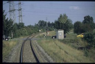
Untere Havelwasserstraße km neu 56,2 - 57,4; km alt 112,0 - 113,1 (Brandenburger Havel)
- Reference number
-
57 WSD K 5223 A
- Context
-
Rep. 57 Wasserstraßendirektion Potsdam - Karten >> Wasserstraßenamt Genthin >> Vermessungs- und Kartenwesen >> Brandenburger Havel >> Lagepläne
- Holding
-
57 WSD K (15603) Rep. 57 Wasserstraßendirektion Potsdam - Karten
- Date of creation
-
1897-1913
- Other object pages
- Last update
-
07.04.2025, 11:33 AM CEST
Data provider
This object is provided by:
Brandenburgisches Landeshauptarchiv. If you have any questions about the object, please contact the data provider.
Brandenburgisches Landeshauptarchiv. If you have any questions about the object, please contact the data provider.
Object type
- Archivale
Time of origin
- 1897-1913
Other Objects (12)

Untere Havelwasserstraße km neu 57,4 - 58,3; km alt 111 - 112,9 (Brandenburger Havel)
Untere Havelwasserstraße. Blatt 40 - km neu 55,11 - 56,2 Vorstadtschleuse West
Obere Havelwasserstraße km 0 bis km 60,7
Untere Havelwasserstraße. Km 115,1 - Km 117,4
Untere Havelwasserstraße, Km 137 - 163
Übergang in km 0+562
Untere Havelwasserstraße. Untere Havel Km 50,8 - Km 52,3
Untere Havelwasserstraße. Untere Havel Km 132,1 - Km 134,3
Untere Havelwasserstraße. Untere Havel Km 58,0 - Km 60,2
Untere Havelwasserstraße. Untere Havel Km 19,7 - Km 21,9
Untere Havelwasserstraße. Untere Havel Km 52,4 - Km 54,2
Untere Havelwasserstraße. Untere Havel Km 42,9 - Km 44,0
Untere Havelwasserstraße km neu 57,4 - 58,3; km alt 111 - 112,9 (Brandenburger Havel)
Untere Havelwasserstraße. Blatt 40 - km neu 55,11 - 56,2 Vorstadtschleuse West
Obere Havelwasserstraße km 0 bis km 60,7
Untere Havelwasserstraße. Km 115,1 - Km 117,4
Untere Havelwasserstraße, Km 137 - 163
Übergang in km 0+562
Untere Havelwasserstraße. Untere Havel Km 50,8 - Km 52,3
Untere Havelwasserstraße. Untere Havel Km 132,1 - Km 134,3
Untere Havelwasserstraße. Untere Havel Km 58,0 - Km 60,2
Untere Havelwasserstraße. Untere Havel Km 19,7 - Km 21,9
Untere Havelwasserstraße. Untere Havel Km 52,4 - Km 54,2