- Alternative title
-
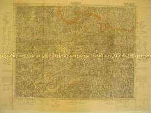
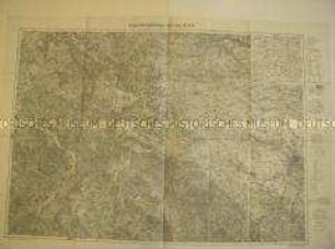
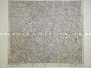
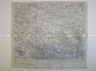
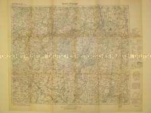
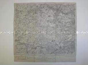
Einheitsblatt Nr. 129
Saarlautern
- Location
-
Deutsches Historisches Museum, Berlin
- Inventory number
-
Do 74/334I
- Measurements
-
Höhe x Breite: 58,4 x 75 cm
- Material/Technique
-
Papier, gedruckt
- Classification
-
Kartografie (Gattung)
- Subject (what)
-
Topographie
- Event
-
Herstellung
- (who)
-
Herausgeber: Deutsche Wehrmacht ?
- (where)
-
Deutschland [historisch: Deutsches Reich]
- (when)
-
1937
- Rights
-
Deutsches Historisches Museum
- Last update
-
24.03.2023, 9:26 AM CET
Data provider
This object is provided by:
Stiftung Deutsches Historisches Museum. If you have any questions about the object, please contact the data provider.
Stiftung Deutsches Historisches Museum. If you have any questions about the object, please contact the data provider.
Object type
- Topographische Karte
Associated
- Herausgeber: Deutsche Wehrmacht ?
Time of origin
- 1937
Other Objects (12)
Topografische Karte des Raumes Saarbrücken
Topografische Karte zu einem Manöver im Raum Kassel/Erfurt

Topografische Karte zu einem Manöver im Raum Kassel/Erfurt
6606 Saarlautern

Topografische Karte des Amtsbezirkes Stockach
Topografische Karte der Lüneburger Heide
Topografische Karte des Truppenübungsplatz Altengrabow
Topografische Karte von Stettin und Umgebung
Topografische Karte von Oebisfelde und Umgebung
Topografische Karte von Güstrow und Umbegebung
Topografische Karte des Gebietes um Gnesen
Topografische Karte des Gebietes um Buxtehude
Topografische Karte des Raumes Saarbrücken
Topografische Karte zu einem Manöver im Raum Kassel/Erfurt
Topografische Karte zu einem Manöver im Raum Kassel/Erfurt
6606 Saarlautern
Topografische Karte des Amtsbezirkes Stockach
Topografische Karte der Lüneburger Heide
Topografische Karte des Truppenübungsplatz Altengrabow
Topografische Karte von Stettin und Umgebung
Topografische Karte von Oebisfelde und Umgebung
Topografische Karte von Güstrow und Umbegebung
Topografische Karte des Gebietes um Gnesen