
- Location
-
IAI Berlin
- Extent
-
1 Kt, [Ca. 1:200.000]
- Material
-
Karte
- Language
-
Englisch
- Notes
-
Maßstab in graph. Form (French Leagues). - S oben. - Ohne Kt.-Netz
Titel oben Mitte. - Mit 2 Ansichten: The Prospect of Cape Cassepourry in America Ms. at 4 L. at S.W. The Prospect of the Island Cayenne, being one League 1/4 at Sea. Mit 2 Nebenkt.:Town and Fort St. Lewis att Cayenne. A Mapp of ye Harbour of the Cul de Sac Royal in ye Island Martinico
- Series
-
Altkarten-Projekt des IAI
- Contributor
-
Kip, Johannes
Churchill, Awnsham
- Published
-
London : Awnsham Churchill , 1739
Berlin : Ibero-Amerikanisches Institut
- PURL
- Last update
-
09.05.2025, 3:03 PM CEST
Data provider
This object is provided by:
Ibero-Amerikanisches Institut - Stiftung Preußischer Kulturbesitz. If you have any questions about the object, please contact the data provider.
Ibero-Amerikanisches Institut - Stiftung Preußischer Kulturbesitz. If you have any questions about the object, please contact the data provider.
Object type
- Karte
Associated
- Kip, Johannes
- Churchill, Awnsham
Time of origin
- London : Awnsham Churchill , 1739
- Berlin : Ibero-Amerikanisches Institut
Other Objects (12)
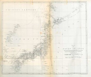
Map of the Japan Islands
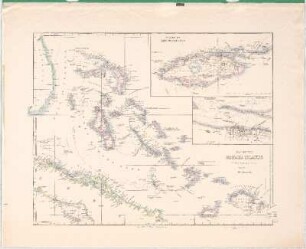
Map Of The Bahama Islands
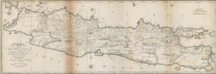
Map of the Island of Java
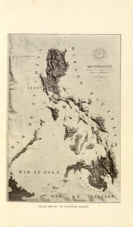
Relief map of the Philippine Islands
Map of the Island of Bombay
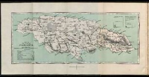
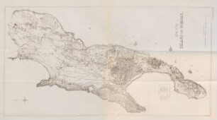
Map of the Island of Jamaica

Index map Philippine Islands

A map of the island of Billiton
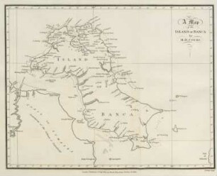
A map of the island of Banca
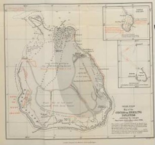
Map of the Cocos or Keeling Islands
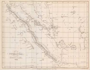
Map of Sumatra and the adjacent islands. 1840
A map of the island of St. Domingo
Map of the Japan Islands
Map Of The Bahama Islands
Map of the Island of Java
Relief map of the Philippine Islands
Map of the Island of Bombay
Map of the Island of Jamaica
Index map Philippine Islands
A map of the island of Billiton
A map of the island of Banca
Map of the Cocos or Keeling Islands
Map of Sumatra and the adjacent islands. 1840