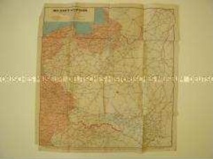
Administrative Karte
Administrative Karte von Deutschland und den Nachbarländern aus der Zeit des Ersten Weltkrieges
- Alternative title
-
Karte des Französischen-Belgischen-Englischen und Russischen Kriegsschauplatzes
- Location
-
Deutsches Historisches Museum, Berlin
- Inventory number
-
Do2 2016/2040
- Measurements
-
Höhe x Breite: 53 x 72 cm
- Material/Technique
-
Papier, gedruckt
- Classification
-
Kartografie (Gattung)
- Subject (what)
-
Weltkrieg, 1.
- Event
-
Herstellung
- (where)
-
Deutschland ? [historisch: Deutsches Reich ?]
- (when)
-
zwischen 1914 und 1918
- Rights
-
Deutsches Historisches Museum
- Last update
-
24.03.2023, 9:28 AM CET
Data provider
This object is provided by:
Stiftung Deutsches Historisches Museum. If you have any questions about the object, please contact the data provider.
Stiftung Deutsches Historisches Museum. If you have any questions about the object, please contact the data provider.
Object type
- Administrative Karte
Time of origin
- zwischen 1914 und 1918
Other Objects (12)

Administrative Karte von Mitteleuropa aus der Zeit des Ersten Weltkrieges

Geologische Karte von Preußen und den Nachbarländern
Politische Karte von Deutschland und den Nachbarländern

Administrative Karte von Kroatien in der Zeit des Zweiten Weltkrieges

Karte von Emin Pascha's Gebiet und den Nachbarländern
Politisch-geografische Karte von Polen und seinen Nachbarländern

Politisch-administrative und ethnologische Karte Europas aus der Zeit des Ersten Weltkrieges im Umschlag mit Begleittext

Gesundheitsdaten: Von Nachbarländern lernen
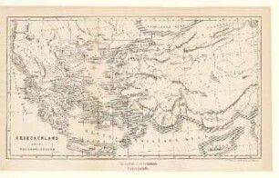
Griechenland nebst den Nachbarländern
Geografische Karte vom Westteil Deutschlands und den westlichen Nachbarländern
Administrative Karte der deutsch-polnischen Grenze aus dem Vorfeld des 2. Weltkrieges

Süd-Deutschland mit dessen Nachbarländern
Administrative Karte von Mitteleuropa aus der Zeit des Ersten Weltkrieges
Geologische Karte von Preußen und den Nachbarländern
Politische Karte von Deutschland und den Nachbarländern
Administrative Karte von Kroatien in der Zeit des Zweiten Weltkrieges
Karte von Emin Pascha's Gebiet und den Nachbarländern
Politisch-geografische Karte von Polen und seinen Nachbarländern
Politisch-administrative und ethnologische Karte Europas aus der Zeit des Ersten Weltkrieges im Umschlag mit Begleittext
Gesundheitsdaten: Von Nachbarländern lernen
Griechenland nebst den Nachbarländern
Geografische Karte vom Westteil Deutschlands und den westlichen Nachbarländern
Administrative Karte der deutsch-polnischen Grenze aus dem Vorfeld des 2. Weltkrieges