- Reference number
-
57 WSD K 5391 A
- Context
-
Rep. 57 Wasserstraßendirektion Potsdam - Karten >> Wasserstraßenamt Rathenow >> Vermessungs- und Kartenwesen >> Untere Havel >> Lagepläne mit Einmündung Hohennauener Kanal
- Holding
-
57 WSD K (15603) Rep. 57 Wasserstraßendirektion Potsdam - Karten
- Date of creation
-
1904-1916
- Other object pages
- Last update
-
07.04.2025, 11:29 AM CEST
Data provider
This object is provided by:
Brandenburgisches Landeshauptarchiv. If you have any questions about the object, please contact the data provider.
Brandenburgisches Landeshauptarchiv. If you have any questions about the object, please contact the data provider.
Object type
- Archivale
Time of origin
- 1904-1916
Other Objects (12)

Unterer Havelwasserstraße km neu 147,4 - 148,3; km alt 12,0 - 12,9
Untere Havelwasserstraße von Km 136,9 - 148,6 (Sacrow-Paretzer Wasserstraße). Km 144,2 - 146,5

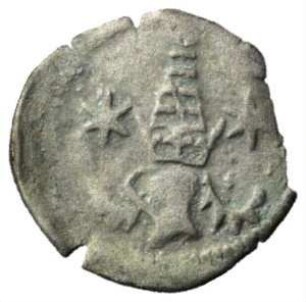
Fundmünze, Pfennig, 1465 - 1474
Fundmünze, Pfennig, 1465 - 1474
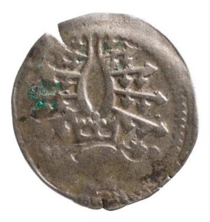
Münze, Pfennig, 1465/1474
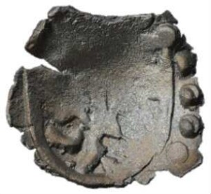
Münze, Hohlheller, 1465 - 1474
Unterer Havelwasserstraße km neu 144,7 - 145,6; km alt 14,7 - 15,6
Unterer Havelwasserstraße. Blatt [38] Havelberg - Schleusenkanal Havelberg km 145,5 - 147,0; Untere Havel km 145,0 - 147,0
Obere Havelwasserstraße km 0 bis km 60,7
Untere Havelwasserstraße. Km 115,1 - Km 117,4
Untere Havelwasserstraße, Km 137 - 163
Situationsplan der Gemarkung Offenburg Streckenausschnitt: 146,5 bis 147,0 km
Unterer Havelwasserstraße km neu 147,4 - 148,3; km alt 12,0 - 12,9
Untere Havelwasserstraße von Km 136,9 - 148,6 (Sacrow-Paretzer Wasserstraße). Km 144,2 - 146,5
Fundmünze, Pfennig, 1465 - 1474
Fundmünze, Pfennig, 1465 - 1474
Münze, Pfennig, 1465/1474
Münze, Hohlheller, 1465 - 1474
Unterer Havelwasserstraße km neu 144,7 - 145,6; km alt 14,7 - 15,6
Unterer Havelwasserstraße. Blatt [38] Havelberg - Schleusenkanal Havelberg km 145,5 - 147,0; Untere Havel km 145,0 - 147,0
Obere Havelwasserstraße km 0 bis km 60,7
Untere Havelwasserstraße. Km 115,1 - Km 117,4
Untere Havelwasserstraße, Km 137 - 163