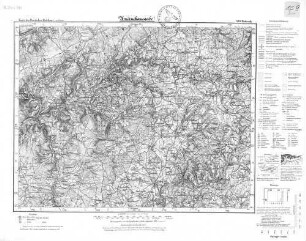
Karte / Plan
[Topographische Karte Belgiens:] Malmédy. Institut cartographique militaire 1924.
- Alt-/Vorsignatur
-
IIIbis
- Maße
-
Maßstab: [1:40.000]
- Bemerkungen
-
Auf Leinwand aufgezogen
- Kontext
-
RW Karten >> 1. Topographische Karten >> 1.3. Landesaufnahme Ausland >> 1.3.3. Europa >> 1.3.3.2. Belgien
- Bestand
-
RW Karten
- Laufzeit
-
1924
- Weitere Objektseiten
- Provenienz
-
Diverse Registraturbildner
- Geliefert über
- Letzte Aktualisierung
-
17.09.2025, 15:38 MESZ
Datenpartner
Dieses Objekt wird bereitgestellt von:
Landesarchiv Nordrhein-Westfalen. Abteilung Rheinland. Bei Fragen zum Objekt wenden Sie sich bitte an den Datenpartner.
Landesarchiv Nordrhein-Westfalen. Abteilung Rheinland. Bei Fragen zum Objekt wenden Sie sich bitte an den Datenpartner.
Objekttyp
- Karten / Pläne
Entstanden
- 1924
Ähnliche Objekte (12)

Belgien, Eupen-Malmedy
Belgien, vorwiegend Eupen-Malmedy
Eupen - Malmedy (1924 - 1930)

Belgien. Liege. Malmedy. Nepomuk Brueckenstatue
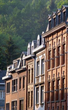
Belgien. Liege. Malmedy. Typische Bürgerhäuser
Grenze mit Belgien, Eupen - Malmedy

Malmedy, topographische Karte, Generalstabskarte 52
Hohes Venn : Belgien, Eupen, Spa, Malmedy
"Grenz-Echo", Zeitung, Eupen-Malmedy (Belgien)
Rigo, Eugen geb. in Malmedy (Belgien)
Finanzielle Fragen mit Belgien über Eupen-Malmedy
480. Malmedy: Malmedy
Belgien, Eupen-Malmedy
Belgien, vorwiegend Eupen-Malmedy
Eupen - Malmedy (1924 - 1930)
Belgien. Liege. Malmedy. Nepomuk Brueckenstatue
Belgien. Liege. Malmedy. Typische Bürgerhäuser
Grenze mit Belgien, Eupen - Malmedy
Malmedy, topographische Karte, Generalstabskarte 52
Hohes Venn : Belgien, Eupen, Spa, Malmedy
"Grenz-Echo", Zeitung, Eupen-Malmedy (Belgien)
Rigo, Eugen geb. in Malmedy (Belgien)
Finanzielle Fragen mit Belgien über Eupen-Malmedy