Karte / Plan
Dortmund (Dortmund) Feldfluren (um 1775) 20.Jh. 3000 Schritte = 17,5 cm 54 x 57 Nachdruck B Nr. 1230
- Former reference number
-
B 1230
- Further information
-
Ort: Dortmund, Dortmund
- Context
-
Karten A (Allgemein) >> 2. Land- und Forstwirtschaft >> 2.2. Katasterkarten
- Holding
-
W 051 Karten A (Allgemein)
- Indexentry place
-
Dortmund, Dortmund
Dortmund, Kataster(Feldfluren), 1960
- Date of creation
-
1960
- Other object pages
- Provenance
-
Sammlungsregistraturbildner
- Delivered via
- Last update
-
05.11.2025, 3:46 PM CET
Data provider
This object is provided by:
Landesarchiv Nordrhein-Westfalen. Abteilung Westfalen. If you have any questions about the object, please contact the data provider.
Landesarchiv Nordrhein-Westfalen. Abteilung Westfalen. If you have any questions about the object, please contact the data provider.
Object type
- Karten / Pläne
Time of origin
- 1960
Other Objects (12)

Karte der Feldfluren von Dortmund um 1775.

"Karte der Feldfluren von Dortmund von 1775"
Verzeichnisse 18.-20.Jh.
Verbesserung der Feldfluren
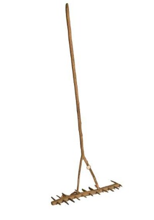
Holzrechen, 1. Hälfte 20.Jh.
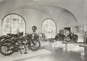
Serien- und Rennmaschinen, 20.Jh.
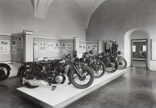
Serien- und Rennmaschinen, 20.Jh.
Familienanzeigen u.ä. 19./20.Jh.
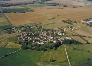
Ortsansicht mit Feldfluren (Haufendorf)
Bittgänge um die Feldfluren
Die Bewachung der Feldfluren
Vermessung der Ochtmerslebenschen Feldfluren
Karte der Feldfluren von Dortmund um 1775.
"Karte der Feldfluren von Dortmund von 1775"
Verzeichnisse 18.-20.Jh.
Verbesserung der Feldfluren
Holzrechen, 1. Hälfte 20.Jh.
Serien- und Rennmaschinen, 20.Jh.
Serien- und Rennmaschinen, 20.Jh.
Familienanzeigen u.ä. 19./20.Jh.
Ortsansicht mit Feldfluren (Haufendorf)
Bittgänge um die Feldfluren
Die Bewachung der Feldfluren