- Alternative title
-
CARTE / DU / DÉPARTEMENT du NORD / OU
- Location
-
Deutsches Historisches Museum, Berlin
- Inventory number
-
Do 2006/127.1-2
- Measurements
-
Höhe x Breite: 58,5 x 71,5 cm (Blatt 1)
Höhe x Breite: 39,3 x 50,7 cm (Karte 1)
Höhe x Breite: 44 x 55 cm (Platte 1)
Höhe x Breite: 58,3 x 72 cm (Blatt 2)
Höhe x Breite: 39,5 x 51,8 cm (Karte 2)
Höhe x Breite: 43,7 x 55 cm (Platte 2)
- Material/Technique
-
Druckfarbe, Papier, Kupferstich, koloriert
- Classification
-
Kartografie (Gattung)
- Subject (what)
-
Frankreich
Niederlande
Flandern
Hennegau
Cambresis
- Event
-
Herstellung
- (who)
-
Geograph, Kartograf, Stecher, Verleger: Jean-Baptiste de Bouge
- (where)
-
Frankreich ?
- (when)
-
1794
- Rights
-
Deutsches Historisches Museum
- Last update
-
24.03.2023, 9:32 AM CET
Data provider
This object is provided by:
Stiftung Deutsches Historisches Museum. If you have any questions about the object, please contact the data provider.
Stiftung Deutsches Historisches Museum. If you have any questions about the object, please contact the data provider.
Object type
- Regionalkarte
Associated
- Geograph, Kartograf, Stecher, Verleger: Jean-Baptiste de Bouge
Time of origin
- 1794
Other Objects (12)
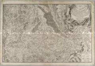
Carte Topographique du Cours du Rhin
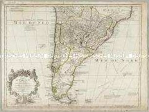
Carte du Paraguay du Chili du Detroit de Magellan &c.
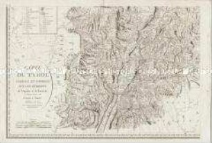
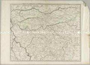
Carte du Tyrol. Mit einer Nebenkarte: Carte Générale
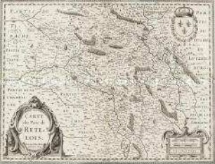
Carte du Pais de Retelois
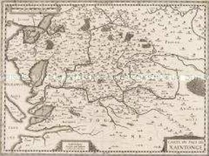
Carte du Pais de Xaintonge
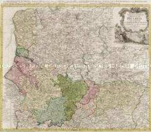
Carte du Gouvernement General De Picardie
Carte du Comté de la Marck
Carte du Pérou et Brésil sepl.
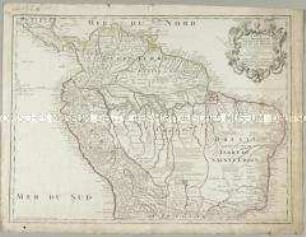
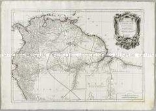
Carte de la Terre ferme du Perou, du Bresil et du Pays des Amazones
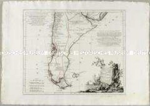
Carte du Chili Méridional, du Rio de la Plata, des Patagons, et du Détroit de Magellan
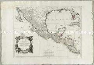
Carte du Mexique et de la Nouvelle Espagne

Carte du Pais de Vallais ou Wallisser-Land
Carte Topographique du Cours du Rhin
Carte du Paraguay du Chili du Detroit de Magellan &c.
Carte du Tyrol. Mit einer Nebenkarte: Carte Générale
Carte du Pais de Retelois
Carte du Pais de Xaintonge
Carte du Gouvernement General De Picardie
Carte du Comté de la Marck
Carte du Pérou et Brésil sepl.
Carte de la Terre ferme du Perou, du Bresil et du Pays des Amazones
Carte du Chili Méridional, du Rio de la Plata, des Patagons, et du Détroit de Magellan
Carte du Mexique et de la Nouvelle Espagne