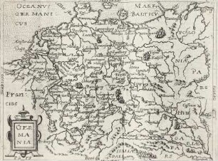
- Location
-
Sächsische Landesbibliothek - Staats- und Universitätsbibliothek Dresden (SLUB), Kartensammlung (öffentliche Sammlung)
- Inventory number
-
Tab. geogr. B Germ. 4110 = A 9031
- Other number(s)
-
df_hauptkatalog_0166693 (Aufnahmenummer)
30117390 (Dokumentennummer)
- Classification
-
Druckgrafik (Gattung)
- Subject (event)
-
Herstellung
- (when)
-
vor 1815
- (description)
-
Erschaffung abgebildetes Objekt
Stich & koloriert (Material/Technik)
- Event
-
Fotografische Aufnahme
- (who)
-
Kramer, Rudolph (Fotograf)
- (when)
-
1966
- Sponsorship
-
Digitalisierungsprojekt: Landesdigitalisierungsprogramm Sachsen: Altbestand Deutsche Fotothek
- Rights
-
Bitte beachten Sie die Nutzungsbedingungen der Deutschen Fotothek.
- Last update
- 05.03.2025, 4:31 PM CET
Data provider
This object is provided by:
Deutsche Fotothek. If you have any questions about the object, please contact the data provider.
Deutsche Fotothek. If you have any questions about the object, please contact the data provider.
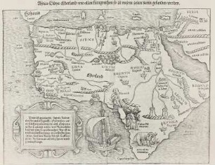
Object type
- Landkarte
Associated
- Kramer, Rudolph (Fotograf)
Time of origin
- 1966
- vor 1815
Other Objects (12)

Karte der Bergungsorte des Sammelgutes
Speculum orbis terrae
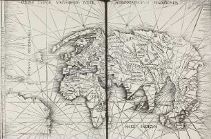
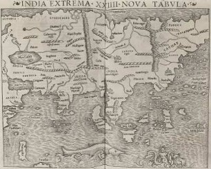
Ptolemäus auctus, restitutus, emaculatus
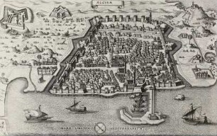
Ansicht der Stadt Algier im 17. Jh.
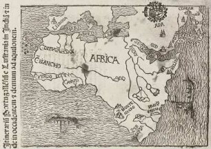
Itinerarium Portugallensium: Afrika
Claudius Ptolemäus: Geographia universalis, vetus et nova
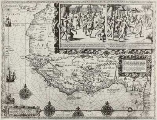
Westsudan und Sitten der Einwohner von Guinea und Benin
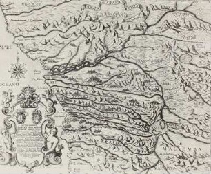
Karte des Kgr. Kongo im 16. Jahrhundert

" ... Kriegstheatrum im Unterelsaß ..." (Rheintal von Kehl bis Germersheim)
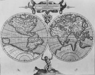
Descriptionis Ptolemaicae augmentum
Afrika-Karte
!["Hos Globos Terracque ac Coelestem dicat et donat RmoP.D. Sigismundo Pollitio a Placentia ... P. M. Coronelli cosmographus P" - dargestellt in 12 Globus-Segmenten : Hos Globos Terracqueum, ac Caetestem dicat, et donat Rmo. P.D. Sigismundo Pollitio à Placentia Praeposito Generali Manachorum Eremitarum S. Hyeronimi Congreg, Lombardiae / [gez. von:] Marco Vincenzo Coronelli. - In Venetia , [ca. 1688]. - 1 Kt. : Kupferst. ; 47 x 24 cm // Engraved; a set of 12 terrestrial globe gores to fit a globe 151 mm. (6 inches) in diameter. - The prime meridian touches the most westerly of the Canary Islands. - Two tracks are drawn and named: "Viaggio di Giacomo Mayre 1616," and "Viaggio da Siam à Brest fatto nel 1686." - The set is one of a pair](https://iiif.deutsche-digitale-bibliothek.de/image/2/738fd267-9d32-4708-bb62-6fbc3123c00c/full/!306,450/0/default.jpg)
"Hos Globos Terracque ac Coelestem dicat et donat RmoP.D. Sigismundo Pollitio a Placentia ... P. M. Coronelli cosmographus P" - dargestellt in 12 Globus-Segmenten : Hos Globos Terracqueum, ac Caetestem dicat, et donat Rmo. P.D. Sigismundo Pollitio à Placentia Praeposito Generali Manachorum Eremitarum S. Hyeronimi Congreg, Lombardiae / [gez. von:] Marco Vincenzo Coronelli. - In Venetia , [ca. 1688]. - 1 Kt. : Kupferst. ; 47 x 24 cm // Engraved; a set of 12 terrestrial globe gores to fit a globe 151 mm. (6 inches) in diameter. - The prime meridian touches the most westerly of the Canary Islands. - Two tracks are drawn and named: "Viaggio di Giacomo Mayre 1616," and "Viaggio da Siam à Brest fatto nel 1686." - The set is one of a pair
Karte der Bergungsorte des Sammelgutes
Speculum orbis terrae
Ptolemäus auctus, restitutus, emaculatus
Ansicht der Stadt Algier im 17. Jh.
Itinerarium Portugallensium: Afrika
Claudius Ptolemäus: Geographia universalis, vetus et nova
Westsudan und Sitten der Einwohner von Guinea und Benin
Karte des Kgr. Kongo im 16. Jahrhundert
" ... Kriegstheatrum im Unterelsaß ..." (Rheintal von Kehl bis Germersheim)
Descriptionis Ptolemaicae augmentum
Afrika-Karte