Kupferstich (koloriert)
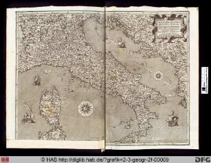
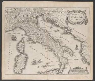
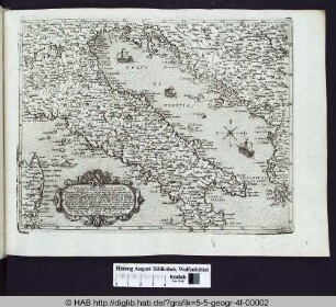
Italien, Landkarte
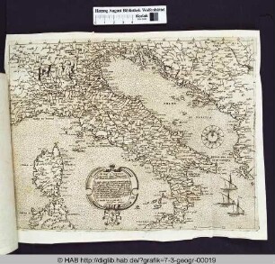
Ansicht einer Landkarte von Italien. Das Blatt enthält 10 Stadt-Lagepläne, eine Stadtansicht vom Hafen von Leghorn und eine kleine Übersichtskarte mit angrenzenden Herrschaften. Außerdem eine kleine Ansicht der Civita Vecchia. Das Blatt enthält außer den Angaben in der Inschrift noch einen Verkaufshinweis und eine Notiz über die Bestimmung der Entfernungen und der Art der Straßen. Die Karte ist dem Geographen Herman Moll (1654-1732) gewidmet und war bei ihm erhältlich. Beschriftung: A New MAP of the Upper Part of ITALY Containing ye Prinicipality of PIEMONT ye Dutchies of SAVOY, MILAN, PARMA, MANTUA, MODENA, TUSCANY, the Dominions of ye POPE & c. The Republique of VENICE, GENOA, LUCCA & c. To His Most Sacred Majesty GEORGE II. KING OF GREAT BRITAIN, FRANCE and IRELAND. ELECTOR of BRUNSWICK-LUNEBURG & c. This MAP is most humbly Dedicated by H. Moll Geographer. 1731.
- Location
-
Stiftung Händel-Haus Halle, Halle (Saale)
- Collection
-
Bilder- und Graphiksammlung
- Inventory number
-
BS-IIc 81
- Measurements
-
H: ca. 64,2 cm; B: ca. 104,7 cm (Blattmaß). H: ca. 62,6 cm; B: ca. 104,3 cm (Plattenmaß).
- Material/Technique
-
Kupferstich (koloriert)
- Subject (what)
-
Widmung
Ansicht (Abbildung)
Kupferstich
Landkarte
Notiz
- Event
-
Veröffentlichung
- (who)
-
Moll, Herman
- (when)
-
1731
- (description)
-
Veröffentlicht
- Rights
-
Stiftung Händel-Haus Halle
- Last update
-
28.03.2025, 12:09 PM CET
Data provider
Stiftung Händel-Haus. If you have any questions about the object, please contact the data provider.
Object type
- Kupferstich (koloriert)
Associated
- Moll, Herman
Time of origin
- 1731
Other Objects (12)
Landkarte (Italien).

Italien, Landkarte
Italien, Landkarte
Landkarte von Italien.
Landkarte (Italien, Lombardei).
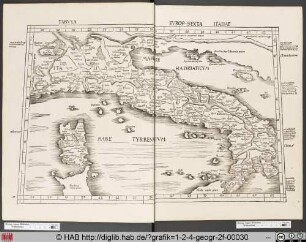
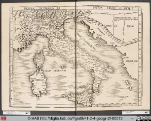
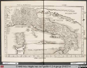
Ptolemäische Landkarte von Italien.
Landkarte von Italien und Umgebung.
Landkarte von Italien und Sizilien.
Landkarte von Italien und Mitelmeer.

Landkarte Italien - aus Stumpff/Schweizer Chronik

Fischer, Theodor; Lana / Südtirol (Italien); Landkarte - Stadtplan
Landkarte : Landkarte Angolas
Landkarte (Italien).
Italien, Landkarte
Italien, Landkarte
Landkarte von Italien.
Landkarte (Italien, Lombardei).
Ptolemäische Landkarte von Italien.
Landkarte von Italien und Umgebung.
Landkarte von Italien und Sizilien.
Landkarte von Italien und Mitelmeer.
Landkarte Italien - aus Stumpff/Schweizer Chronik
Fischer, Theodor; Lana / Südtirol (Italien); Landkarte - Stadtplan