Band
Neueste Reisebeschreibungen, oder Jakob Cooks dritte und letzte Reise welche auf Befehl des Königs von England nach den Südinseln des stillen Meers und dann weiter nach den nord-amerikanischen und asiatischen Küsten, um die Möglichkeit einer nördlichen Durchfahrt nach Europa zu entscheiden, in den Jahren 1776 bis 1780 unternommen worden

- Location
-
Universitätsbibliothek Tübingen -- Fc 8-1
- VD 18
-
VD18 90747739
- Language
-
Deutsch
- Bibliographic citation
-
Cook, James. - Neueste Reisebeschreibungen, oder Jakob Cooks dritte und letzte Reise welche auf Befehl des Königs von England nach den Südinseln des stillen Meers und dann weiter nach den nord-amerikanischen und asiatischen Küsten, um die Möglichkeit einer nördlichen Durchfahrt nach Europa zu entscheiden, in den Jahren 1776 bis 1780 unternommen worden : Mit Kupfern
- Creator
-
Cook, James
- Published
-
Leipzig ; Nürnberg , 1786
- Sponsorship
-
Ministerium für Wissenschaft, Forschung und Kunst Baden-Württemberg
- DOI
-
10.20345/digitue.20511
- URN
-
urn:nbn:de:bsz:21-dt-205115
- Last update
-
29.10.2025, 2:19 PM CET
Data provider
This object is provided by:
Eberhard Karls Universität Tübingen. Universitätsbibliothek. If you have any questions about the object, please contact the data provider.
Eberhard Karls Universität Tübingen. Universitätsbibliothek. If you have any questions about the object, please contact the data provider.
Object type
- Band
Associated
- Cook, James
Time of origin
- Leipzig ; Nürnberg , 1786
Other Objects (12)

Neueste Reisebeschreibungen, oder Jakob Cooks dritte und letzte Reise welche auf Befehl des Königs von England nach den Südinseln des stillen Meers und dann weiter nach den nord-amerikanischen und asiatischen Küsten, um die Möglichkeit einer nördlichen Durchfahrt nach Europa zu entscheiden, in den Jahren 1776 bis 1780 unternommen worden : Mit Kupfern
![Karte der Ostküste von Neusüdwales in Australien, 1:2 200 000, Kupferstich, 1770 : Carte d'une Partie de la Cote de la Nle. Galles Merid le Depius Le Cap Tribulation Jusqu'au Détroit De L'Endeavour = Carte von einem Theil der Küste von Neu-Süd-Wallis vom Vorgebirge Tribulation an bis nach der Strasse Endevaour / Par Le Lieut. J. Cook. - [Ca. 1:2 200 000]. - [S.l.] , 1770. - 1 Kt. : Kupferstich ; 32 x 28 cm](https://iiif.deutsche-digitale-bibliothek.de/image/2/dd3c2f18-562f-4954-9ef1-926756ab57cb/full/!306,450/0/default.jpg)
Karte der Ostküste von Neusüdwales in Australien, 1:2 200 000, Kupferstich, 1770 : Carte d'une Partie de la Cote de la Nle. Galles Merid le Depius Le Cap Tribulation Jusqu'au Détroit De L'Endeavour = Carte von einem Theil der Küste von Neu-Süd-Wallis vom Vorgebirge Tribulation an bis nach der Strasse Endevaour / Par Le Lieut. J. Cook. - [Ca. 1:2 200 000]. - [S.l.] , 1770. - 1 Kt. : Kupferstich ; 32 x 28 cm
![Karte der Belle-Isle-Straße zwischen Labrador und Neufundland in Canada, 1:225 000, Kupferstich, 1766 : chart of the Straights of Bellisle with part of the coast of Newfoundland and Labradore : from actual surveys / Taken by order of Commodore Pallisser, Governor of Newfoundland, Labrador, &ca. By James Cook, surveyor. Larken, sculp.. - [Ca. 1:225 000]. - London : J. Mount & T. Page , 1766. - 1 Kt. : Kupferstich ; 61 x 78 cm](https://iiif.deutsche-digitale-bibliothek.de/image/2/ac114102-0dd0-41a6-a59c-fc301bd33480/full/!306,450/0/default.jpg)
Karte der Belle-Isle-Straße zwischen Labrador und Neufundland in Canada, 1:225 000, Kupferstich, 1766 : chart of the Straights of Bellisle with part of the coast of Newfoundland and Labradore : from actual surveys / Taken by order of Commodore Pallisser, Governor of Newfoundland, Labrador, &ca. By James Cook, surveyor. Larken, sculp.. - [Ca. 1:225 000]. - London : J. Mount & T. Page , 1766. - 1 Kt. : Kupferstich ; 61 x 78 cm
![Karte der Südküste von Neufundland in Canada, 1:225 000, Kupferstich, 1767 : Chart Of Part of the South Coast of Newfoundland : Including the Islands St. Peters And Miquelon with the Southern Entrance into the Gulph of St. Laurence / from actual Surveys Taken by Order of Commodore Pallisser. By James Cook. Larken sculp. 1767. Published by Permission, of the Right Honble. the Lords Commissioners of the Admiralty by James Cook. - [Ca. 1:220 000]. - London : I. Mount and T. Page, Thos. Jefferys, Andw. Dury And Carrington Bowles , 1767. - 1 Kt. : Kupferstich ; 173 x 63 cm](https://iiif.deutsche-digitale-bibliothek.de/image/2/80aea37e-e978-4099-85d4-5cf5ce9f4dab/full/!306,450/0/default.jpg)
Karte der Südküste von Neufundland in Canada, 1:225 000, Kupferstich, 1767 : Chart Of Part of the South Coast of Newfoundland : Including the Islands St. Peters And Miquelon with the Southern Entrance into the Gulph of St. Laurence / from actual Surveys Taken by Order of Commodore Pallisser. By James Cook. Larken sculp. 1767. Published by Permission, of the Right Honble. the Lords Commissioners of the Admiralty by James Cook. - [Ca. 1:220 000]. - London : I. Mount and T. Page, Thos. Jefferys, Andw. Dury And Carrington Bowles , 1767. - 1 Kt. : Kupferstich ; 173 x 63 cm
![Iames Cook : [Kupferstichportrait]](https://iiif.deutsche-digitale-bibliothek.de/image/2/9376ed60-3498-4d2c-97ab-118d321ea8e5/full/!306,450/0/default.jpg)
Iames Cook : [Kupferstichportrait]

Brief

Cooks Leben

Bundesrepublik, Medaille auf James Cook
Bundesrepublik, Medaille auf James Cook
![Karte der Wasserstraße Le Marie in Patagonien, 1:2 650 000, Kupferstich, 1769 : Charte von dem S.O. Theil von Terra del Fuego mit Inbegriff der Straße le Marie und einem Theil von Staaten Land=Carte de la partie S.E. de la Terre de Feu comprenant le Detroit De Le Maire et une partie de la Terre des Etats = Plan de la Baye Du Bon Succés dans le D?troit de la Maire / durch den Lieut. I Cook. C. B. Glaßbach sculps.. - [Ca. 1:2 650 000]. - [S.l.] , [nach 1769]. - 2 Kt. auf 1 Bl. : Kupferstich](https://iiif.deutsche-digitale-bibliothek.de/image/2/13eb0190-c6c1-4ab4-9353-b95f223c2140/full/!306,450/0/default.jpg)
Karte der Wasserstraße Le Marie in Patagonien, 1:2 650 000, Kupferstich, 1769 : Charte von dem S.O. Theil von Terra del Fuego mit Inbegriff der Straße le Marie und einem Theil von Staaten Land=Carte de la partie S.E. de la Terre de Feu comprenant le Detroit De Le Maire et une partie de la Terre des Etats = Plan de la Baye Du Bon Succés dans le D?troit de la Maire / durch den Lieut. I Cook. C. B. Glaßbach sculps.. - [Ca. 1:2 650 000]. - [S.l.] , [nach 1769]. - 2 Kt. auf 1 Bl. : Kupferstich

Porträt des James Cook
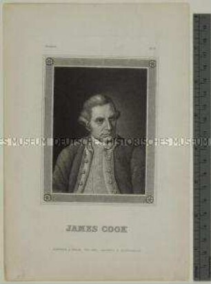
Porträt des britischen Entdeckungsreisenden James Cook
Neueste Reisebeschreibungen, oder Jakob Cooks dritte und letzte Reise welche auf Befehl des Königs von England nach den Südinseln des stillen Meers und dann weiter nach den nord-amerikanischen und asiatischen Küsten, um die Möglichkeit einer nördlichen Durchfahrt nach Europa zu entscheiden, in den Jahren 1776 bis 1780 unternommen worden : Mit Kupfern
Karte der Ostküste von Neusüdwales in Australien, 1:2 200 000, Kupferstich, 1770 : Carte d'une Partie de la Cote de la Nle. Galles Merid le Depius Le Cap Tribulation Jusqu'au Détroit De L'Endeavour = Carte von einem Theil der Küste von Neu-Süd-Wallis vom Vorgebirge Tribulation an bis nach der Strasse Endevaour / Par Le Lieut. J. Cook. - [Ca. 1:2 200 000]. - [S.l.] , 1770. - 1 Kt. : Kupferstich ; 32 x 28 cm
Karte der Belle-Isle-Straße zwischen Labrador und Neufundland in Canada, 1:225 000, Kupferstich, 1766 : chart of the Straights of Bellisle with part of the coast of Newfoundland and Labradore : from actual surveys / Taken by order of Commodore Pallisser, Governor of Newfoundland, Labrador, &ca. By James Cook, surveyor. Larken, sculp.. - [Ca. 1:225 000]. - London : J. Mount & T. Page , 1766. - 1 Kt. : Kupferstich ; 61 x 78 cm
Karte der Südküste von Neufundland in Canada, 1:225 000, Kupferstich, 1767 : Chart Of Part of the South Coast of Newfoundland : Including the Islands St. Peters And Miquelon with the Southern Entrance into the Gulph of St. Laurence / from actual Surveys Taken by Order of Commodore Pallisser. By James Cook. Larken sculp. 1767. Published by Permission, of the Right Honble. the Lords Commissioners of the Admiralty by James Cook. - [Ca. 1:220 000]. - London : I. Mount and T. Page, Thos. Jefferys, Andw. Dury And Carrington Bowles , 1767. - 1 Kt. : Kupferstich ; 173 x 63 cm
Iames Cook : [Kupferstichportrait]
Brief
Cooks Leben
Bundesrepublik, Medaille auf James Cook
Bundesrepublik, Medaille auf James Cook
Karte der Wasserstraße Le Marie in Patagonien, 1:2 650 000, Kupferstich, 1769 : Charte von dem S.O. Theil von Terra del Fuego mit Inbegriff der Straße le Marie und einem Theil von Staaten Land=Carte de la partie S.E. de la Terre de Feu comprenant le Detroit De Le Maire et une partie de la Terre des Etats = Plan de la Baye Du Bon Succés dans le D?troit de la Maire / durch den Lieut. I Cook. C. B. Glaßbach sculps.. - [Ca. 1:2 650 000]. - [S.l.] , [nach 1769]. - 2 Kt. auf 1 Bl. : Kupferstich
Porträt des James Cook