- Alternative title
-
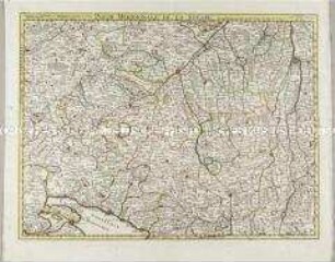
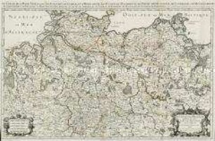
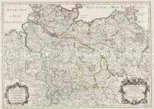
CERCLE DE SOUABE, / dans lequel sont distingués / les principaux Etats, et les Enclaves / DE LA MAISON D'AUTRICHE
- Location
-
Deutsches Historisches Museum, Berlin
- Inventory number
-
Do 2006/865
- Measurements
-
Höhe x Breite: 55 x 78,5 cm (Blatt)
Höhe x Breite: 46 x 49,7 cm (Karte)
Höhe x Breite: 48,6 x 52,6 cm (Platte)
- Material/Technique
-
Papier, Kupferstich, grenzkoloriert
- Classification
-
Kartografie (Gattung)
- Subject (what)
-
Schwäbischer Reichskreis
Deutschland
- Event
-
Herstellung
- (who)
-
Kartograf, Geograph: Didier Robert de Vaugondy
Stecher, Kartograf: Paolo Santini
Kartograf, Verleger: Giuseppe Antonio Remondini
- (where)
-
Venedig, Italien
- (when)
-
um 1778
- Rights
-
Deutsches Historisches Museum
- Last update
-
24.03.2023, 9:27 AM CET
Data provider
This object is provided by:
Stiftung Deutsches Historisches Museum. If you have any questions about the object, please contact the data provider.
Stiftung Deutsches Historisches Museum. If you have any questions about the object, please contact the data provider.
Object type
- Kreiskarte
Associated
- Kartograf, Geograph: Didier Robert de Vaugondy
- Stecher, Kartograf: Paolo Santini
- Kartograf, Verleger: Giuseppe Antonio Remondini
Time of origin
- um 1778
Other Objects (12)

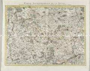
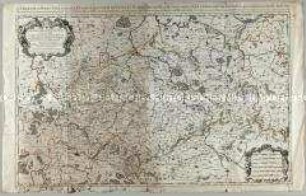
Partie Septentrionale De La Souabe / Partie Méridionale De La Souabe
Grand Theatre de la Guerre: Partie meridionale de la Souabe
Grand Theatre de la Guerre: Partie sepentrionale de la Souabe
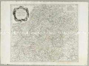
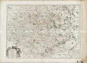
Cercle de Franconie

Le Cercle de Baviere
Cercle de Basse Saxe
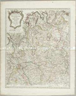
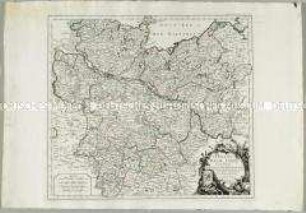
Le Cercle de Westphalie
Le Cercle De Basse Saxe
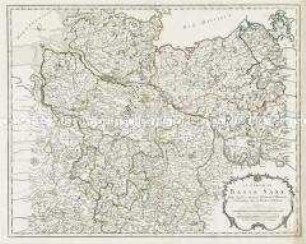
Le Cercle de la Haute Saxe
Cercle Meridional de la Haute Saxe
Le Cercle de la Basse Saxe
Le Cercle De La Basse Saxe
Partie Septentrionale De La Souabe / Partie Méridionale De La Souabe
Grand Theatre de la Guerre: Partie meridionale de la Souabe
Grand Theatre de la Guerre: Partie sepentrionale de la Souabe
Cercle de Franconie
Le Cercle de Baviere
Cercle de Basse Saxe
Le Cercle de Westphalie
Le Cercle De Basse Saxe
Le Cercle de la Haute Saxe
Cercle Meridional de la Haute Saxe
Le Cercle de la Basse Saxe