- Reference number
-
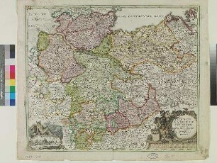
D 73, 4/166
- Dimensions
-
Höhe: 60, Breite: 69, Maßstab: ca. 1:800.000
- Context
-
Allgemeine Kartensammlung (bisherige Kartei) >> 15. Staaten, Welt- und Erdteile, Länder, Kreise >> 15.6. Kreise, Landkreise, Reichskreise
- Holding
-
D 73 Allgemeine Kartensammlung (bisherige Kartei)
- Date of creation
-
ca. 1700
- Other object pages
- Provenance
-
Behörden, Institutionen, Einzelpersonen (Sammlungen)
- Delivered via
- Last update
-
05.11.2025, 3:14 PM CET
Data provider
This object is provided by:
Landesarchiv Nordrhein-Westfalen. Abteilung Ostwestfalen-Lippe. If you have any questions about the object, please contact the data provider.
Landesarchiv Nordrhein-Westfalen. Abteilung Ostwestfalen-Lippe. If you have any questions about the object, please contact the data provider.
Object type
- Karten / Pläne
Time of origin
- ca. 1700
Other Objects (12)

Karte vom (Reichs-)Kreis Westfalen
Karte vom (Reichs-)Kreis Westfalen
Karte vom (Reichs-)Kreis Westfalen
Karte vom (Reichs-)Kreis Westfalen
Karte vom (Reichs-)Kreis Westfalen
Karte vom (Reichs-)Kreis Westfalen. (2 Expl.)
Niederrheinisch-Westfälischer Reichskreis 1794 - Karte
Niederrheinisch-Westfälischer Reichskreis 1560 - Karte
Der Niederrheinisch-Westfälische Reichskreis um 1560 und 1794 - Kommentar
Karte vom Niedersächsischen Reichskreis
Westfalen-Karte
Der Bayeriche [Reichs-]Kreis
Karte vom (Reichs-)Kreis Westfalen
Karte vom (Reichs-)Kreis Westfalen
Karte vom (Reichs-)Kreis Westfalen
Karte vom (Reichs-)Kreis Westfalen
Karte vom (Reichs-)Kreis Westfalen
Karte vom (Reichs-)Kreis Westfalen. (2 Expl.)
Niederrheinisch-Westfälischer Reichskreis 1794 - Karte
Niederrheinisch-Westfälischer Reichskreis 1560 - Karte
Der Niederrheinisch-Westfälische Reichskreis um 1560 und 1794 - Kommentar
Karte vom Niedersächsischen Reichskreis
Westfalen-Karte