Karten und Pläne
Art: Grundriss. Dargestelltes räuml. Thema: Waldgründe von Untertanen des Almosenamtes der Reichsstadt Nürnberg bei Regelsbach. Historisches Territorium: Reichsstadt Nürnberg. Modernes Territorium: Landkreis Roth
- Reference number
-
Plansammlung 10360
- Dimensions
-
34,0 x 45,5
- Formal description
-
Trägermaterial: Papier
Ausführung: Federzeichnung, koloriert
- Context
-
Plansammlung >> Plansammlung
- Holding
-
Plansammlung
- Indexentry place
-
Nürnberg (krfr.St.): Almosenamt
Regelsbach (Gde. Rohr, Lkr. Roth)
- Date of creation
-
1760
- Other object pages
- Last update
-
03.04.2025, 1:36 PM CEST
Data provider
This object is provided by:
Bayerisches Hauptstaatsarchiv. If you have any questions about the object, please contact the data provider.
Bayerisches Hauptstaatsarchiv. If you have any questions about the object, please contact the data provider.
Object type
- Karten und Pläne
Time of origin
- 1760
Other Objects (12)

Gutachten über die Leuchtenberger Lehen im Territorium der Reichsstadt Nürnberg
Ansprüche Kurpfalzbayerns auf einen Teil des Territoriums der Reichsstadt Nürnberg
Art: Hybrid. Darstellungsmethode: Vogelschau. Dargestelltes räuml. Thema: Grenzen des Jagdbezirks der Reichsstadt Memmingen. Historisches Territorium: Reichsstadt Memmingen. Modernes Territorium: Kreisfreie Stadt Memmingen
Art: Hybrid. Darstellungsmethode: Vogelschau. Dargestelltes räuml. Thema: Grenzen des Jagdbezirks der Reichsstadt Memmingen. Historisches Territorium: Reichsstadt Memmingen. Modernes Territorium: Kreisfreie Stadt Memmingen
Titel: Die Nürnberger Heiltümer. Art: Sonstige Darstellungen. Darstellungsmethode: Ansicht. Historisches Territorium: Reichsstadt Nürnberg. Modernes Territorium: Kreisfreie Stadt Nürnberg
Jagd im Territorium der Reichsstadt Dortmund
Titel: Der Burgfrieden der freien Reichsstadt Regensburg. Art: Grundriss. Historisches Territorium: Reichsstadt Regensburg. Historisches Territorium: Gericht Haidau. Modernes Territorium: Kreisfreie Stadt Regensburg
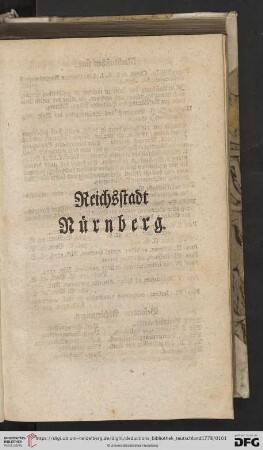
Reichsstadt Nürnberg

Reichsstadt Nürnberg
Reichsstadt Nuernberg
Titel: Fraisbezirk des Nürnbergischen Amtes Lauf. Art: Grundriss. Maßstab: 1000 geometrische Schuhe = 4,4 mm. Historisches Territorium: Reichsstadt Nürnberg. Modernes Territorium: Kreisfreie Stadt Nürnberg. Modernes Territorium: Landkreis Nürnberger Land
Art: Grundriss. Dargestelltes räuml. Thema: Die Wildbanngrenze zwischen der Reichsstadt Rothenburg und dem Fürstentum Brandenburg-Ansbach im Bereich von Rödersdorf und Pleikartshof. Historisches Territorium: Markgrafentum Brandenburg-Ansbach. Historisches Territorium: Reichsstadt Rothenburg. Modernes Territorium: Landkreis Ansbach
Gutachten über die Leuchtenberger Lehen im Territorium der Reichsstadt Nürnberg
Ansprüche Kurpfalzbayerns auf einen Teil des Territoriums der Reichsstadt Nürnberg
Art: Hybrid. Darstellungsmethode: Vogelschau. Dargestelltes räuml. Thema: Grenzen des Jagdbezirks der Reichsstadt Memmingen. Historisches Territorium: Reichsstadt Memmingen. Modernes Territorium: Kreisfreie Stadt Memmingen
Art: Hybrid. Darstellungsmethode: Vogelschau. Dargestelltes räuml. Thema: Grenzen des Jagdbezirks der Reichsstadt Memmingen. Historisches Territorium: Reichsstadt Memmingen. Modernes Territorium: Kreisfreie Stadt Memmingen
Titel: Die Nürnberger Heiltümer. Art: Sonstige Darstellungen. Darstellungsmethode: Ansicht. Historisches Territorium: Reichsstadt Nürnberg. Modernes Territorium: Kreisfreie Stadt Nürnberg
Jagd im Territorium der Reichsstadt Dortmund
Titel: Der Burgfrieden der freien Reichsstadt Regensburg. Art: Grundriss. Historisches Territorium: Reichsstadt Regensburg. Historisches Territorium: Gericht Haidau. Modernes Territorium: Kreisfreie Stadt Regensburg
Reichsstadt Nürnberg
Reichsstadt Nürnberg
Reichsstadt Nuernberg
Titel: Fraisbezirk des Nürnbergischen Amtes Lauf. Art: Grundriss. Maßstab: 1000 geometrische Schuhe = 4,4 mm. Historisches Territorium: Reichsstadt Nürnberg. Modernes Territorium: Kreisfreie Stadt Nürnberg. Modernes Territorium: Landkreis Nürnberger Land