Regionalkarte
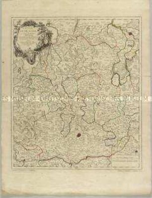
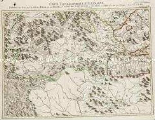
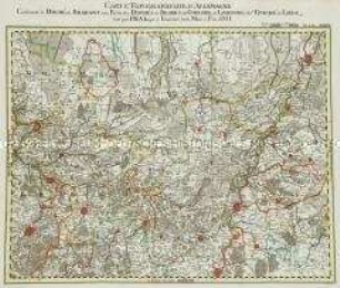
Grand Atlas . Bl. 61 (Österreich, Böhmen, Bayern): Contenant l'Arche Duché d'Autriche Superieur de l'Enns, et une partie du Royaume de Boheme du Duché de Bavier et l'Eveche de Passau.
- Alternative title
-
CARTE TOPOGRAPHIQUE D'ALLEMAGNE / Contenant l'ARCHE DUCHÉ d'AUTRICHE Superieur de l'Enns, et une partie du ROYAUME de BOHEME du DUCHÉ de BAVIER et l'EVECHE de PASSAU.
- Location
-
Deutsches Historisches Museum, Berlin
- Inventory number
-
Do 2006/1059.61
- Measurements
-
Höhe x Breite: 56,5 x 78 cm, Höhe: 56,5 cm, Breite: 78 cm, Tiefe: 3 cm (Atlas)
Höhe x Breite: 56,5 x 78 cm (Blatt)
Höhe x Breite: 52 x 68 cm (Platte)
Höhe x Breite: 46 x 59 cm (Karte)
- Material/Technique
-
Papier, Kupferstich, koloriert, gebunden |Fadenheftung
- Classification
-
Kartografie (Gattung)
- Subject (what)
-
Deutschland
- Event
-
Herstellung
- (who)
-
Verleger, Militärkartograph: Johann Wilhelm Abraham Jaeger
- (where)
-
Frankfurt (Main) [historisch: Frankfurt, Reichsstadt], Deutschland
- (when)
-
um 1787
- Rights
-
Deutsches Historisches Museum
- Last update
-
24.03.2023, 9:29 AM CET
Data provider
This object is provided by:
Stiftung Deutsches Historisches Museum. If you have any questions about the object, please contact the data provider.
Stiftung Deutsches Historisches Museum. If you have any questions about the object, please contact the data provider.
Object type
- Regionalkarte
Associated
- Verleger, Militärkartograph: Johann Wilhelm Abraham Jaeger
Time of origin
- um 1787
Other Objects (12)
L'Eveché de Munster
Monnaies de l'évéché de Sion
Monnaies de l'évéché de Lausanne
Carte de l'Evêché de Paderborn
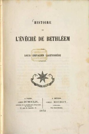
Histoire de l'évêché de Bethléem
Grand Atlas . Bl. 78 (Tirol, Kärnten, Brixen): Contenant une Partie du Comte de Tirol et du Duche de Carinthie Superieure et l'Eveche de Brixen
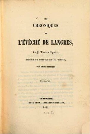
Les Chroniques de l'évêché de Langres
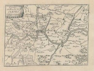
Partie du Duché de Cleves
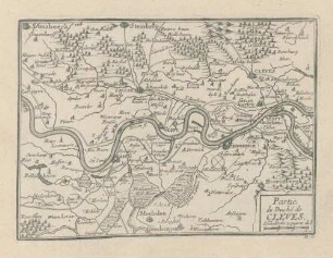
Partie du Duché de Cleves

Novara du Duchè de Milan
Grand Atlas . Bl. 29 (Brabant, Jülich, Geldern, Limburg, Liége): Contenant le Duché de Brabant, une Partie des Duchés de Iuliers, de Gueldre, de Limbourg, de l'Eveché de Liége et et

Bl. LXV: L'Eveché de Hildesheim.
L'Eveché de Munster
Monnaies de l'évéché de Sion
Monnaies de l'évéché de Lausanne
Carte de l'Evêché de Paderborn
Histoire de l'évêché de Bethléem
Grand Atlas . Bl. 78 (Tirol, Kärnten, Brixen): Contenant une Partie du Comte de Tirol et du Duche de Carinthie Superieure et l'Eveche de Brixen
Les Chroniques de l'évêché de Langres
Partie du Duché de Cleves
Partie du Duché de Cleves
Novara du Duchè de Milan
Grand Atlas . Bl. 29 (Brabant, Jülich, Geldern, Limburg, Liége): Contenant le Duché de Brabant, une Partie des Duchés de Iuliers, de Gueldre, de Limbourg, de l'Eveché de Liége et et