Grafik | Landkarte
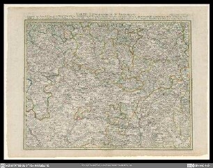
Carte topographique d'Allemagne
Historische Landkarte von Mittelfranken mit kolorierten Gebietsbegrenzungen
- Alternative title
-
Contenant la Franconie scavoir und parte des evêchés de Wurzbourg, de Bamberg, d'Eichstadt et d'Elwang, le marcgraviat de Brandenbourg-Culmbach et d'Anspach, les principautés de Schwarzenberg, de Hohenlohe, d'Oettingen, les comtés de Limpurg et de Castel, le territoire des libres villes ... Nuremberg, Rothenbourg et Halle en Suabe
- Collection
-
Pictothek
- Identifier
-
36/A 1.16-50
- Source
-
Universitätsbibliothek Würzburg
- Extent
-
618 mm x 452 mm
- Language
-
Französisch
- Bibliographic citation
-
BV022491239 - Carte Topographique Allemagne
- Subject
-
Altkarte
- Subject (where)
-
Deutschland
Mittelfranken
- Event
-
Geistige Schöpfung
- (who)
- (when)
-
Ca. 1800
- URN
-
urn:nbn:de:bvb:20-36a11650term73278136-7
- Last update
-
06.03.2025, 3:26 PM CET
Data provider
This object is provided by:
Universitätsbibliothek Würzburg. If you have any questions about the object, please contact the data provider.
Universitätsbibliothek Würzburg. If you have any questions about the object, please contact the data provider.
Object type
- Grafik
- Landkarte
Time of origin
- Ca. 1800
Other Objects (12)
Carte topographique d'Allemagne

Carte Topographique D'Allemagne

Carte Topographique D'Allemagne

Carte Topographique D'Allemagne

Karte 38: Carte Topographique D'Allemagne : Contenant l'Electorat Palatin ...

Karte Topographique D'Allemagne DI/32

Carte Topographique Pour servir de Suite au grand Atlas d'Allemagne

Karte 42: Carte Topographique D'Allemagne : Contenante une Partie de Champagne ...

Karte 34: Carte Topographique D'Allemagne : Contenante le Comté de Namur ...

Karte 44: Carte Topographique D'Allemagne : Contenant une Partie de Suabe ...

Karte 32: Carte Topographique D'Allemagne : Contenant le Duché de Brabant ...

Karte 39: Carte Topographique D'Allemagne : Contenant le Margraviat de l'Alsace ...
Carte topographique d'Allemagne
Carte Topographique D'Allemagne
Carte Topographique D'Allemagne
Carte Topographique D'Allemagne
Karte 38: Carte Topographique D'Allemagne : Contenant l'Electorat Palatin ...
Karte Topographique D'Allemagne DI/32
Carte Topographique Pour servir de Suite au grand Atlas d'Allemagne
Karte 42: Carte Topographique D'Allemagne : Contenante une Partie de Champagne ...
Karte 34: Carte Topographique D'Allemagne : Contenante le Comté de Namur ...
Karte 44: Carte Topographique D'Allemagne : Contenant une Partie de Suabe ...
Karte 32: Carte Topographique D'Allemagne : Contenant le Duché de Brabant ...