Belagerungskarte
Plan des Positions occupées par les Armées Alliées devant Sevastopol.
- Alternative title
-
PLAN DES POSITIONS / OCCUPÉES / PAR LES ARMÉES ALLIÉES / devant
- Location
-
Deutsches Historisches Museum, Berlin
- Inventory number
-
Do 2006/816
- Measurements
-
Höhe x Breite: 54,6 x 72,6 cm (Blatt)
Höhe x Breite: 51 x 60,5 cm (Karte)
- Material/Technique
-
Papier, Lithographie ?
- Classification
-
Kartografie (Gattung)
- Subject (what)
-
Sewastopol
Ukraine
Russland
- Event
-
Herstellung
- (who)
-
Verleger: Ch. Muquardt
Stecher: J. Claes
- (where)
-
Brüssel?, Belgien ?
- (when)
-
um 1855
- Rights
-
Deutsches Historisches Museum
- Last update
-
24.03.2023, 9:28 AM CET
Data provider
This object is provided by:
Stiftung Deutsches Historisches Museum. If you have any questions about the object, please contact the data provider.
Stiftung Deutsches Historisches Museum. If you have any questions about the object, please contact the data provider.
Object type
- Belagerungskarte
Associated
- Verleger: Ch. Muquardt
- Stecher: J. Claes
Time of origin
- um 1855
Other Objects (12)
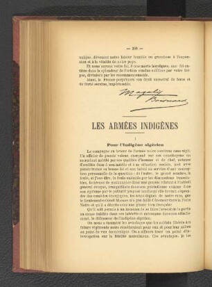
Les Armées Indigènes.

Les armées féodales

'Positions des Armées Autrichiennes, Russes et Prussienne le 6. Sept. 1761.''
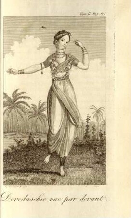
Devedaschie vue par devant

Devant Les Portes.
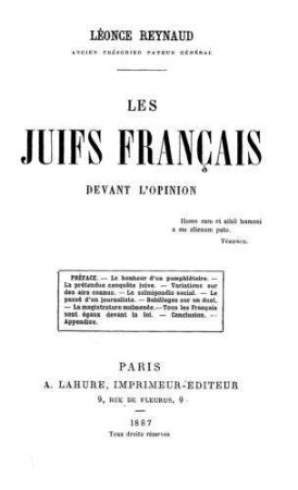
Les juifs français devant l'opinion / par Léonce Reynaud
![Le Socialisme devant le vieux monde ou le vivant devant les morts : Par V[ictor] Considerant. Suivi de: Jésus-Christ devant les conseils de guerre. Par Victor Meunier](https://iiif.deutsche-digitale-bibliothek.de/image/2/09ac15f3-4ef4-4715-9944-d5471bc9c60b/full/!306,450/0/default.jpg)
Le Socialisme devant le vieux monde ou le vivant devant les morts : Par V[ictor] Considerant. Suivi de: Jésus-Christ devant les conseils de guerre. Par Victor Meunier

A- Les Post-Positions
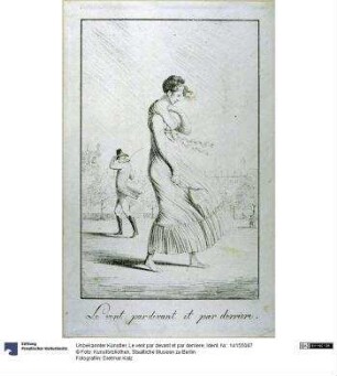
Le vent par devant et par derriere
Par Devant Quel Ivge sont les nobles responsables. Chapitre xviii.

Bd. 37 : Abt. 8 ; Bd. 2: Camps et positions d'armées - 1740 - 1762

Bd. 36 : Abt. 8 ; Bd. 1: Camps et positions d'armées - 1650 - 1740
Les Armées Indigènes.
Les armées féodales
'Positions des Armées Autrichiennes, Russes et Prussienne le 6. Sept. 1761.''
Devedaschie vue par devant
Devant Les Portes.
Les juifs français devant l'opinion / par Léonce Reynaud
Le Socialisme devant le vieux monde ou le vivant devant les morts : Par V[ictor] Considerant. Suivi de: Jésus-Christ devant les conseils de guerre. Par Victor Meunier
A- Les Post-Positions
Le vent par devant et par derriere
Par Devant Quel Ivge sont les nobles responsables. Chapitre xviii.
Bd. 37 : Abt. 8 ; Bd. 2: Camps et positions d'armées - 1740 - 1762