Karte
The location of the line of railway, shown upon this map, was revised in May and June, 1870, by a Joint Commission, appointed by the Company and the Government of Mexico, and the new location from Minatitlan to Salina Cruz is indicated thus -----. Upon this map is also indicated the line of the proposed Ship Canal.

- Sprache
-
Englisch
- Erschienen in
-
Stuckle, Henry. - Interoceanic canals : an essay on the question of location for a ship canal across the American continent
- Erschienen
-
1870
- Letzte Aktualisierung
-
09.04.2025, 13:29 MESZ
Datenpartner
Dieses Objekt wird bereitgestellt von:
Staats- und Universitätsbibliothek Hamburg Carl von Ossietzky. Bei Fragen zum Objekt wenden Sie sich bitte an den Datenpartner.
Staats- und Universitätsbibliothek Hamburg Carl von Ossietzky. Bei Fragen zum Objekt wenden Sie sich bitte an den Datenpartner.
Objekttyp
- Karte
Entstanden
- 1870
Ähnliche Objekte (12)

The effect of distribution of stations upon location error: Statistical tests based on the double-difference earthquake location algorithm and the bootstrap method
The Relative Location of the Dye Staining Endpoint Indicated With Polypropylene Glycol-Based Caries Dye versus Conventional Propylene Glycol-Based Caries Dye
![The transformation of this world depends upon you : [voices from Amherst and beyond]](/assets/placeholder/searchResultMediaNoDigitisedMedia.png)
The transformation of this world depends upon you : [voices from Amherst and beyond]

Chapter XXXVIII. The advance made by the Indians of this province in virtue, and their attendance upon the sacraments
Location, Location, Quality:The Fixed Differentiation Principle
Isolated Terminal Ileal Mucosal Changes: When is the Bite Indicated?
Location, location, location: The geography of innovation and knowledge spillovers
The three most important things about origins: location, location, location
Location, location, location: the evolutionary history of CD1 genes and the NKR-P1/ligand systems
What proportion of children stay in the same location as adults, and how does this vary across location and groups?
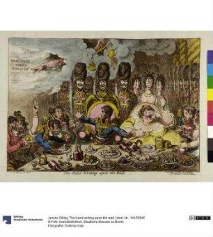
The hand-writing upon the wall
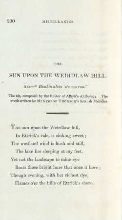
The sun upon the Weirdlaw Hill
The effect of distribution of stations upon location error: Statistical tests based on the double-difference earthquake location algorithm and the bootstrap method
The Relative Location of the Dye Staining Endpoint Indicated With Polypropylene Glycol-Based Caries Dye versus Conventional Propylene Glycol-Based Caries Dye
The transformation of this world depends upon you : [voices from Amherst and beyond]
Chapter XXXVIII. The advance made by the Indians of this province in virtue, and their attendance upon the sacraments
Location, Location, Quality:The Fixed Differentiation Principle
Isolated Terminal Ileal Mucosal Changes: When is the Bite Indicated?
Location, location, location: The geography of innovation and knowledge spillovers
The three most important things about origins: location, location, location
Location, location, location: the evolutionary history of CD1 genes and the NKR-P1/ligand systems
What proportion of children stay in the same location as adults, and how does this vary across location and groups?
The hand-writing upon the wall