- Location
-
Leibniz-Institut für Länderkunde e.V., Leipzig
- Other number(s)
-
HK 0436 (Signatur)
- Material/Technique
-
unkolor.
- Inscription/Labeling
-
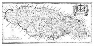
Ohne Maßstab. - Titelkartusche oben links. - Links unten Wappen von Carlisle. - Rechts unten Wappen von Cumberland. - Erl. unten rechts. - Aus: Universal Magazine. London. - Ohne Relief
- Subject (what)
-
Altkarte
Verwaltungskarte
Großbritannien
Cumberland (County)
County
- Event
-
Veröffentlichung
- (who)
-
Kings Arms St. Pauls Church Yard (Verlag)
- (where)
-
London
- (when)
-
1748
- Rights
-
Leibniz-Institut für Länderkunde e.V.
- Last update
- 15.05.2025, 12:43 PM CEST
Data provider
This object is provided by:
Leibniz-Institut für Länderkunde e. V.. If you have any questions about the object, please contact the data provider.
Leibniz-Institut für Länderkunde e. V.. If you have any questions about the object, please contact the data provider.
Object type
- Karte
Associated
- Kings Arms St. Pauls Church Yard (Verlag)
Time of origin
- 1748
Other Objects (12)
A Correct Map of Jamaica

A New and Correct Map of Asia

The GeoMap representation : on topologically correct sub-pixel image analysis

Correct
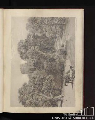
Cumberland
Cumberland
Cumberland.
Biologically correct
Naworth, Cumberland.
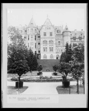
Schloss Cumberland

Palais Cumberland
Hofakten Cumberland
A Correct Map of Jamaica
A New and Correct Map of Asia
The GeoMap representation : on topologically correct sub-pixel image analysis
Correct
Cumberland
Cumberland
Cumberland.
Biologically correct
Naworth, Cumberland.
Schloss Cumberland
Palais Cumberland
Hofakten Cumberland
A Correct Map of Jamaica
A New and Correct Map of Asia
The GeoMap representation : on topologically correct sub-pixel image analysis
Correct
Cumberland
Cumberland
Cumberland.
Biologically correct
Naworth, Cumberland.
Schloss Cumberland
Palais Cumberland