- Alternative title
-
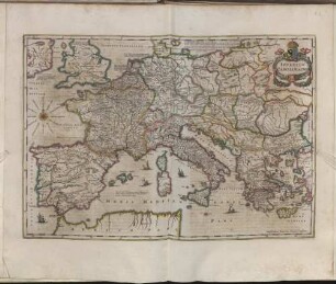
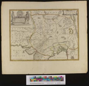
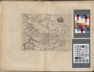
IMPERIUM CAROLI MAGNI / OCCIDENTIS IMPERATORIS / Complectens universam Galliam, in Hispania / quidquid à Pyrenaeis jugis occurrit ad Iberum et
- Location
-
Deutsches Historisches Museum, Berlin
- Inventory number
-
Do 2006/723
- Measurements
-
Höhe x Breite: 57,5 x 79,5 cm (Blatt)
Höhe x Breite: 46,3 x 63 cm (Karte)
Höhe x Breite: 48 x 65 cm (Platte)
- Material/Technique
-
Papier, Kupferstich, grenzkoloriert
- Classification
-
Kartografie (Gattung)
- Subject (what)
-
Geschichte
Heiliges Römisches Reich
Europa
- Event
-
Herstellung
- (who)
-
Geograph, Kartograf: Gilles Robert de Vaugondy?
Verleger, Geograph: Charles François Delamarche
- (where)
-
Paris, Frankreich
- (when)
-
1743
- Rights
-
Deutsches Historisches Museum
- Last update
-
24.03.2023, 9:28 AM CET
Data provider
This object is provided by:
Stiftung Deutsches Historisches Museum. If you have any questions about the object, please contact the data provider.
Stiftung Deutsches Historisches Museum. If you have any questions about the object, please contact the data provider.
Object type
- Historisch-Politische Karte
Associated
- Geograph, Kartograf: Gilles Robert de Vaugondy?
- Verleger, Geograph: Charles François Delamarche
Time of origin
- 1743
Other Objects (12)
Imperium Caroli Magni
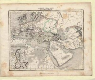
Imperium Caroli Magni & Chalifatus Arabum
Historia Caroli Magni Imperatoris Romani
§. V. De Titulo Caroli Magni Imperatoris.
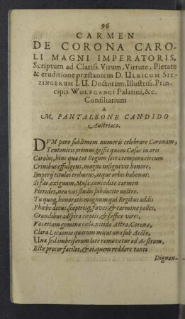
Carmen de Corona Caroli Magni Imperatoris

Vita Et Gesta Caroli Magni Imperatoris Invictissimi
Magni Mogolis imperium
Magni Mogolis Imperium

Quaestio 27. Anne jam Caroli Magni tempore exstitit Imperium Romano-Germanicum?
Caroli imperatoris illius Magni et D. Albini de Rhetorica ... disputatio

Magni chami Tartari Imperium
Magni Chami Tartari Imperium
Imperium Caroli Magni
Imperium Caroli Magni & Chalifatus Arabum
Historia Caroli Magni Imperatoris Romani
§. V. De Titulo Caroli Magni Imperatoris.
Carmen de Corona Caroli Magni Imperatoris
Vita Et Gesta Caroli Magni Imperatoris Invictissimi
Magni Mogolis imperium
Magni Mogolis Imperium
Quaestio 27. Anne jam Caroli Magni tempore exstitit Imperium Romano-Germanicum?
Caroli imperatoris illius Magni et D. Albini de Rhetorica ... disputatio
Magni chami Tartari Imperium