Regionalkarte
Nova et Accuratissima Sinarum Imperii Tabula. Karte erschienen in Blaeu, Joan: Atlas Maior. Lateinische Ausgabe
- Alternative title
-
NOVA ET ACCURATISSIMA SINARUM IMPERII TABULA
- Location
-
Deutsches Historisches Museum, Berlin
- Inventory number
-
Do 2006/169
- Measurements
-
Höhe x Breite: 122 x 155 cm (Blatt)
Höhe x Breite: 105 x 123 cm (Karte)
- Material/Technique
-
Druckfarbe, Papier, Leinwand, Kupferstich, koloriert
- Classification
-
Kartografie (Gattung)
- Subject (what)
-
China
Jesuiten
- Event
-
Herstellung
- (who)
-
Kartograf, Verleger, Stecher: Joan Blaeu
Geograph, Kartograf: Martino Martini
- (where)
-
Amsterdam, Niederlande [historisch: Niederlande, Republik der Vereinigten]
- (when)
-
1658
- Rights
-
Deutsches Historisches Museum
- Last update
-
24.03.2023, 9:29 AM CET
Data provider
This object is provided by:
Stiftung Deutsches Historisches Museum. If you have any questions about the object, please contact the data provider.
Stiftung Deutsches Historisches Museum. If you have any questions about the object, please contact the data provider.
Object type
- Regionalkarte
Associated
- Kartograf, Verleger, Stecher: Joan Blaeu
- Geograph, Kartograf: Martino Martini
Time of origin
- 1658
Other Objects (12)
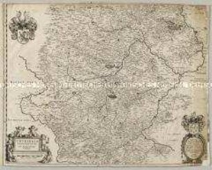
Thuringia Landgraviatus
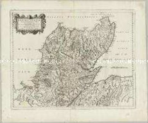
Extima Scotiae Septentrionalis Ora
![Festungsplan von Geldern, 1:2 500, kolorierter Kupferstich, 1649 : Gelre. [Ca. 1:2 500] / Chez. Iean Blaeu. - Amsterdam : [Joan Blaeu], [1649]. - 1 Plan : Kupferst. ; 50,3 x 40,8 cm. - Maßstab in graph. Form (Roeden) - Mit zwei Wappen. - Vermutl. aus: Novum Ac Magnum Theatrum Urbium Belgicae Foederatae. [Teil 2] : Ad praesentis temporis faciem expressum / a Ioanne Blaeu, Amstelaedamensi](https://iiif.deutsche-digitale-bibliothek.de/image/2/360b5bd6-2006-4c3f-9e7e-0a842244db82/full/!306,450/0/default.jpg)
Festungsplan von Geldern, 1:2 500, kolorierter Kupferstich, 1649 : Gelre. [Ca. 1:2 500] / Chez. Iean Blaeu. - Amsterdam : [Joan Blaeu], [1649]. - 1 Plan : Kupferst. ; 50,3 x 40,8 cm. - Maßstab in graph. Form (Roeden) - Mit zwei Wappen. - Vermutl. aus: Novum Ac Magnum Theatrum Urbium Belgicae Foederatae. [Teil 2] : Ad praesentis temporis faciem expressum / a Ioanne Blaeu, Amstelaedamensi
![Ansicht des Real Sitio de San Lorenzo de El Escorial und Rückseite des Blattes, Spanien, Kupferstich, 1665 : Scenographia Fabricae S. Lavrentii in Escvriali. - [Amsterdam] : [Blaeu] , [bis 1662]. - 1 Ansicht : Kupferst. ; 75 x 47 cm // aus: Blaeu, Joan : Qvo Europae Liber XVII, Et Africa Continentvr. - Amstelaedami : Blaeu , 1662. - [2] Bl., XXV, 93 S., [26] Doppels., 165 S., [1] Bl., [13] Doppels. // (Geographiae Blavianae Volvmen ... ; 9)](https://iiif.deutsche-digitale-bibliothek.de/image/2/50b95993-d97a-418d-a8e4-6e4c32e85252/full/!306,450/0/default.jpg)
Ansicht des Real Sitio de San Lorenzo de El Escorial und Rückseite des Blattes, Spanien, Kupferstich, 1665 : Scenographia Fabricae S. Lavrentii in Escvriali. - [Amsterdam] : [Blaeu] , [bis 1662]. - 1 Ansicht : Kupferst. ; 75 x 47 cm // aus: Blaeu, Joan : Qvo Europae Liber XVII, Et Africa Continentvr. - Amstelaedami : Blaeu , 1662. - [2] Bl., XXV, 93 S., [26] Doppels., 165 S., [1] Bl., [13] Doppels. // (Geographiae Blavianae Volvmen ... ; 9)
![Ansicht des Real Sitio de San Lorenzo de El Escorial und Rückseite des Blattes, Spanien, Kupferstich, 1665 : Scenographia Fabricae S. Lavrentii in Escvriali. - [Amsterdam] : [Blaeu] , [bis 1662]. - 1 Ansicht : Kupferst. ; 75 x 47 cm // aus: Blaeu, Joan : Qvo Europae Liber XVII, Et Africa Continentvr. - Amstelaedami : Blaeu , 1662. - [2] Bl., XXV, 93 S., [26] Doppels., 165 S., [1] Bl., [13] Doppels. // (Geographiae Blavianae Volvmen ... ; 9)](https://iiif.deutsche-digitale-bibliothek.de/image/2/08df03c3-02c4-4fae-bbdb-3c1decec3799/full/!306,450/0/default.jpg)
Ansicht des Real Sitio de San Lorenzo de El Escorial und Rückseite des Blattes, Spanien, Kupferstich, 1665 : Scenographia Fabricae S. Lavrentii in Escvriali. - [Amsterdam] : [Blaeu] , [bis 1662]. - 1 Ansicht : Kupferst. ; 75 x 47 cm // aus: Blaeu, Joan : Qvo Europae Liber XVII, Et Africa Continentvr. - Amstelaedami : Blaeu , 1662. - [2] Bl., XXV, 93 S., [26] Doppels., 165 S., [1] Bl., [13] Doppels. // (Geographiae Blavianae Volvmen ... ; 9)
![Stadtplan von Alkmaar in den Niederlande, 1 : 3 500, kolorierter Kupferstich, 1649 : Alcmaria : Viris D. D. Praetori, Consulibus, Scabinis totique Senatui Reipublicae Alcmariensi / Hanc Tabulam D. D. D. Ioannes Blaeu , [ca. 1:3.500] / [Amsterdam] : [Joan Blaeu], [1649]. - 1 Plan : Kupferst. ; 56,2 x 45,0 cm - Mit 2 Wappen - Mit Gebäudeverz. - Vermutl. aus: Novum Ac Magnum Theatrum Urbium Belgicae Foederatae. [Teil 1] : Ad praesentis temporis faciem expressum / a Ioanne Blaeu, Amstelaedamensi](https://iiif.deutsche-digitale-bibliothek.de/image/2/efa28184-26a2-4b07-9263-2eff2e449d4c/full/!306,450/0/default.jpg)
Stadtplan von Alkmaar in den Niederlande, 1 : 3 500, kolorierter Kupferstich, 1649 : Alcmaria : Viris D. D. Praetori, Consulibus, Scabinis totique Senatui Reipublicae Alcmariensi / Hanc Tabulam D. D. D. Ioannes Blaeu , [ca. 1:3.500] / [Amsterdam] : [Joan Blaeu], [1649]. - 1 Plan : Kupferst. ; 56,2 x 45,0 cm - Mit 2 Wappen - Mit Gebäudeverz. - Vermutl. aus: Novum Ac Magnum Theatrum Urbium Belgicae Foederatae. [Teil 1] : Ad praesentis temporis faciem expressum / a Ioanne Blaeu, Amstelaedamensi
![Karte vom Niedersächsischen Reichskreis, 1:1 000 000, Kupferstich, um 1650 : Inferioris Saxoniae Circvlvs : Serenißimo, Celsißimo Principi ac Domino, D. Christiano Ludovico, Brunsvicensium et Lunaeburgensium Duci, &c. Circuli Inferioris Saxoniae Capitaneo Generali Tabulam hanc D.D.D. J. Blaeu / Joannes Blaeu excudebat. - [Ca. 1:1 000 000]. - [Amsterdam] : Blaeu , [um 1650]. - 1 Kt. : Color. Kupferstich ; 51 x 40 cm. Herzog Christian Ludwig von Braunschweig- Lüneburg gewidmet. - Titelkartusche unten links. - Maßstabsangabe in graph. Form (Milliaria Germanica). - W oben](https://iiif.deutsche-digitale-bibliothek.de/image/2/b34d2000-45bb-46d1-8d7f-7f3594f8680d/full/!306,450/0/default.jpg)
Karte vom Niedersächsischen Reichskreis, 1:1 000 000, Kupferstich, um 1650 : Inferioris Saxoniae Circvlvs : Serenißimo, Celsißimo Principi ac Domino, D. Christiano Ludovico, Brunsvicensium et Lunaeburgensium Duci, &c. Circuli Inferioris Saxoniae Capitaneo Generali Tabulam hanc D.D.D. J. Blaeu / Joannes Blaeu excudebat. - [Ca. 1:1 000 000]. - [Amsterdam] : Blaeu , [um 1650]. - 1 Kt. : Color. Kupferstich ; 51 x 40 cm. Herzog Christian Ludwig von Braunschweig- Lüneburg gewidmet. - Titelkartusche unten links. - Maßstabsangabe in graph. Form (Milliaria Germanica). - W oben
![Stadtplan von Mecheln in Belgien 1 : 5 200, kolorierter Kupferstich, 1649 : Machlinia, [ca. 1:5.200] / [Amsterdam] : [Joan Blaeu], [1649]. - 1 Plan : Kupferst. ; 48,4 x 38,0 cm - Vermutl. aus: Novum Ac Magnum Theatrum Urbium Belgicae Foederatae. [Teil 2] : Ad praesentis temporis faciem expressum / a Ioanne Blaeu, Amstelaedamensi](https://iiif.deutsche-digitale-bibliothek.de/image/2/25efcd7e-3523-4b45-8166-89ad546667f7/full/!306,450/0/default.jpg)
Stadtplan von Mecheln in Belgien 1 : 5 200, kolorierter Kupferstich, 1649 : Machlinia, [ca. 1:5.200] / [Amsterdam] : [Joan Blaeu], [1649]. - 1 Plan : Kupferst. ; 48,4 x 38,0 cm - Vermutl. aus: Novum Ac Magnum Theatrum Urbium Belgicae Foederatae. [Teil 2] : Ad praesentis temporis faciem expressum / a Ioanne Blaeu, Amstelaedamensi
![Stadtplan von Zwolle in den Niederlande, 1 : 2 500, kolorierter Kupferstich, 1649 : Swolla : [gewidmet] Viris D. D. Consulibus, Scabinis, Et Consiliariis Lib. Imp. Civitatis Swollae / Tabulam hanc ... D. D. Ioan Blaeu., [ca. 1:2.500] / [Amsterdam] : [Joan Blaeu], 1649 - 1 Plan : Kupferst. ; 52,0 x 41,3 cm - Titelkartusche links unten. - Wappendarst. oben links u. oben rechts - Mit Gebäudeverz. - Wahrschl. aus: Novum Ac Magnum Theatrum Urbium Belgicae Foederatae. [Teil 1] : Ad praesentis temporis faciem expressum / a Ioanne Blaeu, Amstelaedamensi](https://iiif.deutsche-digitale-bibliothek.de/image/2/0bc43206-2251-4639-931f-20743700fa3b/full/!306,450/0/default.jpg)
Stadtplan von Zwolle in den Niederlande, 1 : 2 500, kolorierter Kupferstich, 1649 : Swolla : [gewidmet] Viris D. D. Consulibus, Scabinis, Et Consiliariis Lib. Imp. Civitatis Swollae / Tabulam hanc ... D. D. Ioan Blaeu., [ca. 1:2.500] / [Amsterdam] : [Joan Blaeu], 1649 - 1 Plan : Kupferst. ; 52,0 x 41,3 cm - Titelkartusche links unten. - Wappendarst. oben links u. oben rechts - Mit Gebäudeverz. - Wahrschl. aus: Novum Ac Magnum Theatrum Urbium Belgicae Foederatae. [Teil 1] : Ad praesentis temporis faciem expressum / a Ioanne Blaeu, Amstelaedamensi
![Karte der Arabischen Halbinsel, 1:6 300 000, Kupferstich, 1660 : Arabia. - [Ca. 1:6 300 000]. - [Amstelodami] : [Ioannes Blaeu] , [um 1660]. - 1 Kt. : Kupferst. ; 51 x 40 cm. - Aus: Blaeu, Joan: Atlas Maior, Sive Cosmographia Blauiana, Qua Solum, Salum, Coelum, Accuratissime Describuntur / 10 ; 6. - Maßstab in graph. Form (Milliaria Germanica Communia)](https://iiif.deutsche-digitale-bibliothek.de/image/2/c89aaf76-a1eb-43a6-97ac-8684bb4de7fc/full/!306,450/0/default.jpg)
Karte der Arabischen Halbinsel, 1:6 300 000, Kupferstich, 1660 : Arabia. - [Ca. 1:6 300 000]. - [Amstelodami] : [Ioannes Blaeu] , [um 1660]. - 1 Kt. : Kupferst. ; 51 x 40 cm. - Aus: Blaeu, Joan: Atlas Maior, Sive Cosmographia Blauiana, Qua Solum, Salum, Coelum, Accuratissime Describuntur / 10 ; 6. - Maßstab in graph. Form (Milliaria Germanica Communia)
![Stadtplan von Guda in den Niederlande, 1 : 3 300, kolorierter Kupferstich, 1649 : Govda : [Stadtpl.] [gewidmet:] D. D. Praetori, Consulibus, Scabinis, Totique Senatui, Reipublicæ Goudanæ / Tabulam hanc D. D. Ioh. Blaeu/ [Amsterdam] : [Joan Blaeu], [1649]. - 1 Plan : Kupferst. ; 48,7 x 37,5 cm - Titelkartusche oben links. - Mit 2 Wappen - Mit Gebäudeverz. - Mit Straßenverz.](https://iiif.deutsche-digitale-bibliothek.de/image/2/8fe2514e-5d6b-4292-9d1e-f467a4bbf2df/full/!306,450/0/default.jpg)
Stadtplan von Guda in den Niederlande, 1 : 3 300, kolorierter Kupferstich, 1649 : Govda : [Stadtpl.] [gewidmet:] D. D. Praetori, Consulibus, Scabinis, Totique Senatui, Reipublicæ Goudanæ / Tabulam hanc D. D. Ioh. Blaeu/ [Amsterdam] : [Joan Blaeu], [1649]. - 1 Plan : Kupferst. ; 48,7 x 37,5 cm - Titelkartusche oben links. - Mit 2 Wappen - Mit Gebäudeverz. - Mit Straßenverz.
![Stadtplan von Namur in Belgien 1 : 3 300, kolorierter Kupferstich, 1649 : Namurcum, [ca. 1:3.300] / [Amsterdam] : [Joan Blaeu], [1649]. - 1 Plan : Kupferst. ; 49,8 x 37,7 cm - Mit 1 wappen . - Mit Gebäudeverz. - Vermutl. aus: Novum Ac Magnum Theatrum Urbium Belgicae Foederatae. [Teil 2] : Ad praesentis temporis faciem expressum / a Ioanne Blaeu, Amstelaedamensi](https://iiif.deutsche-digitale-bibliothek.de/image/2/14956fb8-ed4d-45e9-a846-189b79e310e0/full/!306,450/0/default.jpg)
Stadtplan von Namur in Belgien 1 : 3 300, kolorierter Kupferstich, 1649 : Namurcum, [ca. 1:3.300] / [Amsterdam] : [Joan Blaeu], [1649]. - 1 Plan : Kupferst. ; 49,8 x 37,7 cm - Mit 1 wappen . - Mit Gebäudeverz. - Vermutl. aus: Novum Ac Magnum Theatrum Urbium Belgicae Foederatae. [Teil 2] : Ad praesentis temporis faciem expressum / a Ioanne Blaeu, Amstelaedamensi
Thuringia Landgraviatus
Extima Scotiae Septentrionalis Ora
Festungsplan von Geldern, 1:2 500, kolorierter Kupferstich, 1649 : Gelre. [Ca. 1:2 500] / Chez. Iean Blaeu. - Amsterdam : [Joan Blaeu], [1649]. - 1 Plan : Kupferst. ; 50,3 x 40,8 cm. - Maßstab in graph. Form (Roeden) - Mit zwei Wappen. - Vermutl. aus: Novum Ac Magnum Theatrum Urbium Belgicae Foederatae. [Teil 2] : Ad praesentis temporis faciem expressum / a Ioanne Blaeu, Amstelaedamensi
Ansicht des Real Sitio de San Lorenzo de El Escorial und Rückseite des Blattes, Spanien, Kupferstich, 1665 : Scenographia Fabricae S. Lavrentii in Escvriali. - [Amsterdam] : [Blaeu] , [bis 1662]. - 1 Ansicht : Kupferst. ; 75 x 47 cm // aus: Blaeu, Joan : Qvo Europae Liber XVII, Et Africa Continentvr. - Amstelaedami : Blaeu , 1662. - [2] Bl., XXV, 93 S., [26] Doppels., 165 S., [1] Bl., [13] Doppels. // (Geographiae Blavianae Volvmen ... ; 9)
Ansicht des Real Sitio de San Lorenzo de El Escorial und Rückseite des Blattes, Spanien, Kupferstich, 1665 : Scenographia Fabricae S. Lavrentii in Escvriali. - [Amsterdam] : [Blaeu] , [bis 1662]. - 1 Ansicht : Kupferst. ; 75 x 47 cm // aus: Blaeu, Joan : Qvo Europae Liber XVII, Et Africa Continentvr. - Amstelaedami : Blaeu , 1662. - [2] Bl., XXV, 93 S., [26] Doppels., 165 S., [1] Bl., [13] Doppels. // (Geographiae Blavianae Volvmen ... ; 9)
Stadtplan von Alkmaar in den Niederlande, 1 : 3 500, kolorierter Kupferstich, 1649 : Alcmaria : Viris D. D. Praetori, Consulibus, Scabinis totique Senatui Reipublicae Alcmariensi / Hanc Tabulam D. D. D. Ioannes Blaeu , [ca. 1:3.500] / [Amsterdam] : [Joan Blaeu], [1649]. - 1 Plan : Kupferst. ; 56,2 x 45,0 cm - Mit 2 Wappen - Mit Gebäudeverz. - Vermutl. aus: Novum Ac Magnum Theatrum Urbium Belgicae Foederatae. [Teil 1] : Ad praesentis temporis faciem expressum / a Ioanne Blaeu, Amstelaedamensi
Karte vom Niedersächsischen Reichskreis, 1:1 000 000, Kupferstich, um 1650 : Inferioris Saxoniae Circvlvs : Serenißimo, Celsißimo Principi ac Domino, D. Christiano Ludovico, Brunsvicensium et Lunaeburgensium Duci, &c. Circuli Inferioris Saxoniae Capitaneo Generali Tabulam hanc D.D.D. J. Blaeu / Joannes Blaeu excudebat. - [Ca. 1:1 000 000]. - [Amsterdam] : Blaeu , [um 1650]. - 1 Kt. : Color. Kupferstich ; 51 x 40 cm. Herzog Christian Ludwig von Braunschweig- Lüneburg gewidmet. - Titelkartusche unten links. - Maßstabsangabe in graph. Form (Milliaria Germanica). - W oben
Stadtplan von Mecheln in Belgien 1 : 5 200, kolorierter Kupferstich, 1649 : Machlinia, [ca. 1:5.200] / [Amsterdam] : [Joan Blaeu], [1649]. - 1 Plan : Kupferst. ; 48,4 x 38,0 cm - Vermutl. aus: Novum Ac Magnum Theatrum Urbium Belgicae Foederatae. [Teil 2] : Ad praesentis temporis faciem expressum / a Ioanne Blaeu, Amstelaedamensi
Stadtplan von Zwolle in den Niederlande, 1 : 2 500, kolorierter Kupferstich, 1649 : Swolla : [gewidmet] Viris D. D. Consulibus, Scabinis, Et Consiliariis Lib. Imp. Civitatis Swollae / Tabulam hanc ... D. D. Ioan Blaeu., [ca. 1:2.500] / [Amsterdam] : [Joan Blaeu], 1649 - 1 Plan : Kupferst. ; 52,0 x 41,3 cm - Titelkartusche links unten. - Wappendarst. oben links u. oben rechts - Mit Gebäudeverz. - Wahrschl. aus: Novum Ac Magnum Theatrum Urbium Belgicae Foederatae. [Teil 1] : Ad praesentis temporis faciem expressum / a Ioanne Blaeu, Amstelaedamensi
Karte der Arabischen Halbinsel, 1:6 300 000, Kupferstich, 1660 : Arabia. - [Ca. 1:6 300 000]. - [Amstelodami] : [Ioannes Blaeu] , [um 1660]. - 1 Kt. : Kupferst. ; 51 x 40 cm. - Aus: Blaeu, Joan: Atlas Maior, Sive Cosmographia Blauiana, Qua Solum, Salum, Coelum, Accuratissime Describuntur / 10 ; 6. - Maßstab in graph. Form (Milliaria Germanica Communia)
Stadtplan von Guda in den Niederlande, 1 : 3 300, kolorierter Kupferstich, 1649 : Govda : [Stadtpl.] [gewidmet:] D. D. Praetori, Consulibus, Scabinis, Totique Senatui, Reipublicæ Goudanæ / Tabulam hanc D. D. Ioh. Blaeu/ [Amsterdam] : [Joan Blaeu], [1649]. - 1 Plan : Kupferst. ; 48,7 x 37,5 cm - Titelkartusche oben links. - Mit 2 Wappen - Mit Gebäudeverz. - Mit Straßenverz.