Altkarte
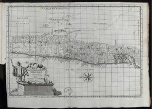
Il Disegno De Geografia Moderna Del Regno di Polonia, e parte Del Ducado di Moscouia, con parte della Scandia, e parte de Sueuia, con molte Regioni ...
- Location
-
Dillingen, Studienbibliothek -- X 122#Nr.31
- Dimensions
-
36 x 52 cm
- Extent
-
1 Karte
- Language
-
Latein
- Notes
-
Kupferstich
Nördliches Blatt. - Kompassrose unten links
- Bibliographic citation
-
[Lafreri-Atlas der Studienbibliothek Dillingen X,122] ; [31]
- Keyword
-
Ostseeraum
- URN
-
urn:nbn:de:bvb:12-bsb00107328-3
- Last update
- 27.11.2025, 8:39 AM CET
Data provider
This object is provided by:
Bayerische Staatsbibliothek. If you have any questions about the object, please contact the data provider.
Bayerische Staatsbibliothek. If you have any questions about the object, please contact the data provider.
Object type
- Altkarte
Associated
Time of origin
- [1562?]
Other Objects (12)

Il Disegno De Geografia Moderna Del Regno di Polonia, e parte Del Ducado di Moscovia, con parte della scandia, e parte de suevia, con molte regioni ...

Il Disegno De Geografia Moderna Del Regno di Polonia, e parte Del Ducado di Moscouia, con parte della Scandia, e parte de Sueuia, con molte Regioni ...

Il Disegno De Geografia Moderna Del Regno di Polonia, e parte Del Ducado di Moscovia, con parte della scandia, e parte de suevia, con molte regioni ...

Mendrisio : con parte del foglio 1374 Como
Del Segretario Di Corte Terza Parte.

Parte Prima. Del tempo di Pace.

Parte Seconda. Del tempo di Guerra.
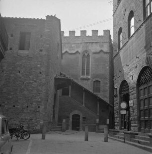
Palazzo del Capitani di Parte Guelfa

Parte seconda: Parallelo di Giulio II. con Leone X.

Parte del Castello di Tortona con il Progetto di corregere Li suoi diffetti quali vengono segnato di gialdo

Del Compendio Dell'Istoria Del Regno Di Napoli ... Parte, 3. Giunta, overo Terza Parte Del Compendio Dell'Istoria Del Regno Di Napoli
Parte Del Tucuman
Il Disegno De Geografia Moderna Del Regno di Polonia, e parte Del Ducado di Moscovia, con parte della scandia, e parte de suevia, con molte regioni ...
Il Disegno De Geografia Moderna Del Regno di Polonia, e parte Del Ducado di Moscouia, con parte della Scandia, e parte de Sueuia, con molte Regioni ...
Il Disegno De Geografia Moderna Del Regno di Polonia, e parte Del Ducado di Moscovia, con parte della scandia, e parte de suevia, con molte regioni ...
Mendrisio : con parte del foglio 1374 Como
Del Segretario Di Corte Terza Parte.
Parte Prima. Del tempo di Pace.
Parte Seconda. Del tempo di Guerra.
Palazzo del Capitani di Parte Guelfa
Parte seconda: Parallelo di Giulio II. con Leone X.
Parte del Castello di Tortona con il Progetto di corregere Li suoi diffetti quali vengono segnato di gialdo
Del Compendio Dell'Istoria Del Regno Di Napoli ... Parte, 3. Giunta, overo Terza Parte Del Compendio Dell'Istoria Del Regno Di Napoli