- Standort
-
Greifswald
- Sammlung
-
Kartensammlung des Instituts für Geographie und Geologie (Universität Greifswald)
- Inventarnummer
-
AT/
- Material/Technik
-
Papier; Kupferstich; Lithographie
- Inschrift/Beschriftung
-
Verantwortlichkeitsangabe: herausgegeben von Adolf Stieler
- Klassifikation
-
Kartographie
- Bezug (wo)
-
Gotha
- Ereignis
-
Herstellung
- (wann)
-
1875
- Letzte Aktualisierung
- 25.03.2025, 09:45 MEZ
Datenpartner
Dieses Objekt wird bereitgestellt von:
Universität Greifswald. Kartensammlung des Instituts für Geographie und Geologie. Bei Fragen zum Objekt wenden Sie sich bitte an den Datenpartner.
Universität Greifswald. Kartensammlung des Instituts für Geographie und Geologie. Bei Fragen zum Objekt wenden Sie sich bitte an den Datenpartner.
Objekttyp
- Atlas
Entstanden
- 1875
Ähnliche Objekte (12)
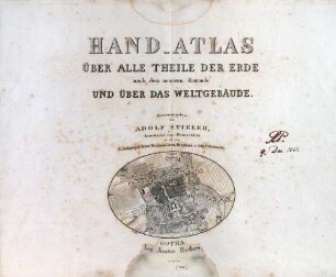
Adolf Stielers Hand-Atlas über alle Theile der Erde und über das Weltgebäude
Adolf Stieler's Hand-Atlas über alle Theile der Erde ; Abtheilung II. ; Dreizehn colorierte Karten in Kupferstich
Adolf Stieler's Hand-Atlas über alle Theile der Erde ; Abtheilung I. ; Sechzehn colorierte Karten in Kupferstich
![Karte von Europa aus Stielers Handatlas, um 1889 : Europa. - 1:15 000 000. - Gotha : Perthes , [ca. 1889]. - 1 Kt. ; mehrfarb. , 40 x 33 cm. +++ Mit 3 Nebenkt. u.d.T.: Strasse von Gibraltar; Gibraltar; Völker von Europa // Karte No. 8 aus: Adolf Stieler's Handatlas über alle Theile der Erde und über das Weltgebäude. - Gotha : Perthes , [ca. 1889]. - 95 Bl., 198 S. : überw. Kt.](https://iiif.deutsche-digitale-bibliothek.de/image/2/352f02d7-2fbb-4854-ac7f-f3b448011f90/full/!306,450/0/default.jpg)
Karte von Europa aus Stielers Handatlas, um 1889 : Europa. - 1:15 000 000. - Gotha : Perthes , [ca. 1889]. - 1 Kt. ; mehrfarb. , 40 x 33 cm. +++ Mit 3 Nebenkt. u.d.T.: Strasse von Gibraltar; Gibraltar; Völker von Europa // Karte No. 8 aus: Adolf Stieler's Handatlas über alle Theile der Erde und über das Weltgebäude. - Gotha : Perthes , [ca. 1889]. - 95 Bl., 198 S. : überw. Kt.

Klub-Weltatlas : E. Debes Handatlas
A. Stieler's Schul-Atlas über alle Theile der Erde und über das Weltgebäude

Schul-Atlas über alle Theile der Erde und das Wichtigste über das Weltgebäude

Meyers Neuer Handatlas ; für Zeitungsleser, Rundfunkhörer und Fernsehteilnehmer

Andrees Allgemeiner Handatlas ; in 126 Haupt- und 137 Nebenkarten
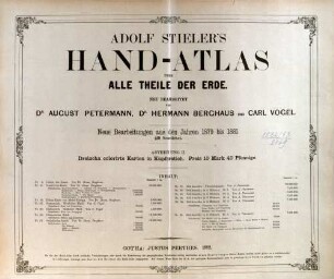
Stielers Hand-Atlas ; 254 Haupt- und Nebenkarten in Kupferstich
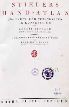
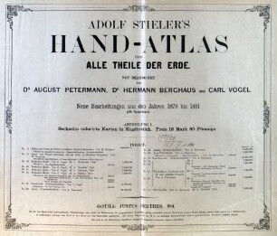
Stielers Hand-Atlas ; 254 Haupt- und Nebenkarten in Kupferstich

Andrees Allgemeiner Handatlas ; in 228 Haupt- und 211 Nebenkarten
Adolf Stielers Hand-Atlas über alle Theile der Erde und über das Weltgebäude
Adolf Stieler's Hand-Atlas über alle Theile der Erde ; Abtheilung II. ; Dreizehn colorierte Karten in Kupferstich
Adolf Stieler's Hand-Atlas über alle Theile der Erde ; Abtheilung I. ; Sechzehn colorierte Karten in Kupferstich
Karte von Europa aus Stielers Handatlas, um 1889 : Europa. - 1:15 000 000. - Gotha : Perthes , [ca. 1889]. - 1 Kt. ; mehrfarb. , 40 x 33 cm. +++ Mit 3 Nebenkt. u.d.T.: Strasse von Gibraltar; Gibraltar; Völker von Europa // Karte No. 8 aus: Adolf Stieler's Handatlas über alle Theile der Erde und über das Weltgebäude. - Gotha : Perthes , [ca. 1889]. - 95 Bl., 198 S. : überw. Kt.
Klub-Weltatlas : E. Debes Handatlas
A. Stieler's Schul-Atlas über alle Theile der Erde und über das Weltgebäude
Schul-Atlas über alle Theile der Erde und das Wichtigste über das Weltgebäude
Meyers Neuer Handatlas ; für Zeitungsleser, Rundfunkhörer und Fernsehteilnehmer
Andrees Allgemeiner Handatlas ; in 126 Haupt- und 137 Nebenkarten
Stielers Hand-Atlas ; 254 Haupt- und Nebenkarten in Kupferstich
Stielers Hand-Atlas ; 254 Haupt- und Nebenkarten in Kupferstich