- Reference number
-
40046 Topographische und Geognostische Karten, Nr. 1-I59 (Zu benutzen im Bergarchiv Freiberg)
- Context
-
40046 Topographische und Geognostische Karten >> 1. Topographische Karte, Deutsches Reich 1:25 000 - Messtischblätter (1900-1935)
- Holding
-
40046 Topographische und Geognostische Karten
- Date of creation
-
aufg. 1904, hrsg. 1906, ngtr. 1909
- Other object pages
- Provenance
-
Prov.: OBA - LF
- Last update
- 10.12.2025, 2:55 PM CET
Data provider
This object is provided by:
Sächsisches Staatsarchiv. If you have any questions about the object, please contact the data provider.
Sächsisches Staatsarchiv. If you have any questions about the object, please contact the data provider.
Object type
- Karten und Pläne
Time of origin
- aufg. 1904, hrsg. 1906, ngtr. 1909
Other Objects (12)

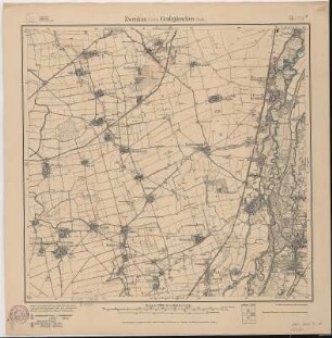
Zwenkau / Großgörschen
Zwenkau - Großgörschen
Grubenfelderbesitz- und Bergbauflächenkarte Kohle, Blatt Zwenkau-Großgörschen
Zwenkau (Sächs.)-Großgörschen (Preuß.)
Zwenkau (Sächs.)-Großgörschen (Preuß.)
Übersicht über das zur Bebauung freigegebene Gelände im Bergamtsbezirk Leipzig - Blatt Zwenkau, Großgörschen
Übersicht der zur Bebauung freigegebenen Gebiete im Leipzig-Bornaer Braunkohlenrevier - Blatt Zwenkau-Großgörschen
![[4739] Zwenkau-Grossgörschen, Geologische Karte von Sachsen](https://iiif.deutsche-digitale-bibliothek.de/image/2/c3410094-4168-4c99-90d3-01ec32827706/full/!306,450/0/default.jpg)
[4739] Zwenkau-Grossgörschen, Geologische Karte von Sachsen
Topographische Karte von Großgörschen-Ost
Sächs. Blatt 25 Zwenkau - Preuß. Blatt 2751 Großgörschen, neu: 4739 Zwenkau
Sächs. Blatt 25 Zwenkau - Preuß. Blatt 2751 Großgörschen, neu: 4739 Zwenkau
Section Zwenkau - Großgörschen aus: Topographische Karte (Meßtischblätter) Sachsen
Zwenkau / Großgörschen
Zwenkau - Großgörschen
Grubenfelderbesitz- und Bergbauflächenkarte Kohle, Blatt Zwenkau-Großgörschen
Zwenkau (Sächs.)-Großgörschen (Preuß.)
Zwenkau (Sächs.)-Großgörschen (Preuß.)
Übersicht über das zur Bebauung freigegebene Gelände im Bergamtsbezirk Leipzig - Blatt Zwenkau, Großgörschen
Übersicht der zur Bebauung freigegebenen Gebiete im Leipzig-Bornaer Braunkohlenrevier - Blatt Zwenkau-Großgörschen
[4739] Zwenkau-Grossgörschen, Geologische Karte von Sachsen
Topographische Karte von Großgörschen-Ost
Sächs. Blatt 25 Zwenkau - Preuß. Blatt 2751 Großgörschen, neu: 4739 Zwenkau
Sächs. Blatt 25 Zwenkau - Preuß. Blatt 2751 Großgörschen, neu: 4739 Zwenkau