Karte / Plan
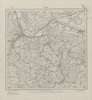
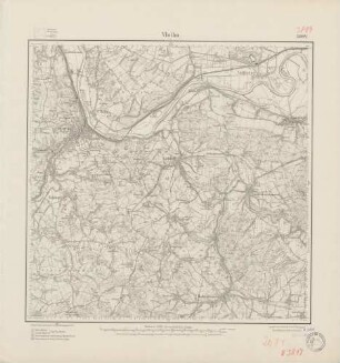
Topographische Karte 3818 Herford-Ost und 3819 Vlotho: Einzeichnung einer Abgrabung oder eines Abbauplatzes in der Nähe von Welstorf
- Reference number
-
D 73, 5/6912
- Dimensions
-
Höhe: 103,5 cm, Breite: 103,5 cm, Maßstab: 1 : 25000
- Context
-
Allgemeine Kartensammlung (VERA-Verzeichnung) >> 1. Allgemeine Sammlung >> 1.17. Topografische Karten >> 1.17.3. Titel 5
- Holding
-
D 73 Allgemeine Kartensammlung (VERA-Verzeichnung)
- Date of creation
-
(1912, 1965 - 1968), [um 1972]
- Other object pages
- Provenance
-
Behörden, Institutionen, Einzelpersonen (Sammlungen)
- Delivered via
- Last update
- 05.11.2025, 3:22 PM CET
Data provider
This object is provided by:
Landesarchiv Nordrhein-Westfalen. Abteilung Ostwestfalen-Lippe. If you have any questions about the object, please contact the data provider.
Landesarchiv Nordrhein-Westfalen. Abteilung Ostwestfalen-Lippe. If you have any questions about the object, please contact the data provider.
Object type
- Karten / Pläne
Time of origin
- (1912, 1965 - 1968), [um 1972]
Other Objects (12)

Wanderkarte Vlotho und Umgebung. Zusammendruck aus topogr. Karten Blatt 3818 und 3819.
3819 Vlotho
Übersichtsplan Vlotho, Meßtischblatt 3819
Bad Oeynhausen. Zusammendruck aus den Messtischblättern 3718, 3719, 3818, 3819
3819 (alte Nr.: 2084) Vlotho
Blatt 2084 Vlotho, neu: 3819
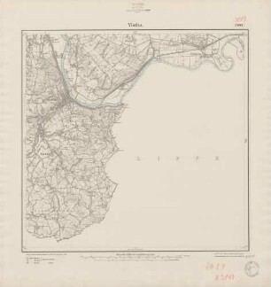
3819 (alte Nr.: 2084) Vlotho
Blatt 2084 Vlotho, neu: 3819
3819 (alte Nr.: 2084) Vlotho
Blatt 2084 Vlotho, neu: 3819
Omnibuslinie 7: Exter-Lohe-Bad Oeynhausen-Vlotho-Valdorf-Bad Senkelteich-Bad Seebruch. Eintragungen auf Messtischblätter 3718, 3719, 3818, 3819.
Geologische Karte GK 25. Blatt 3819 Vlotho
Wanderkarte Vlotho und Umgebung. Zusammendruck aus topogr. Karten Blatt 3818 und 3819.
3819 Vlotho
Übersichtsplan Vlotho, Meßtischblatt 3819
Bad Oeynhausen. Zusammendruck aus den Messtischblättern 3718, 3719, 3818, 3819
3819 (alte Nr.: 2084) Vlotho
Blatt 2084 Vlotho, neu: 3819
3819 (alte Nr.: 2084) Vlotho
Blatt 2084 Vlotho, neu: 3819
3819 (alte Nr.: 2084) Vlotho
Blatt 2084 Vlotho, neu: 3819
Omnibuslinie 7: Exter-Lohe-Bad Oeynhausen-Vlotho-Valdorf-Bad Senkelteich-Bad Seebruch. Eintragungen auf Messtischblätter 3718, 3719, 3818, 3819.