- Alternativer Titel
-
Reichskarte / Einheitsblatt Nr. 90 Spremberg-Sorau-Niesky-Kohlfurt
- Standort
-
Deutsches Historisches Museum, Berlin
- Inventarnummer
-
Do 75/837I
- Maße
-
Höhe x Breite: 67,4 x 79 cm
- Material/Technik
-
Papier, gedruckt
- Klassifikation
-
Karten, Pläne, Risse (Gattung)
- Bezug (was)
-
Topographie
- Ereignis
-
Herstellung
- (wer)
-
Herausgeber: Reichsamt für Landesaufnahme
- (wo)
-
Berlin, Deutschland [historisch: Deutsches Reich]
- (wann)
-
1922
- Rechteinformation
-
Deutsches Historisches Museum
- Letzte Aktualisierung
- 24.03.2023, 09:27 MEZ
Datenpartner
Dieses Objekt wird bereitgestellt von:
Stiftung Deutsches Historisches Museum. Bei Fragen zum Objekt wenden Sie sich bitte an den Datenpartner.
Stiftung Deutsches Historisches Museum. Bei Fragen zum Objekt wenden Sie sich bitte an den Datenpartner.
Objekttyp
- Topografische Karte
Beteiligte
- Herausgeber: Reichsamt für Landesaufnahme
Entstanden
- 1922
Ähnliche Objekte (12)
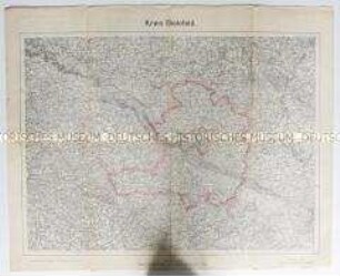
Topografische Karte des Kreises Bielefeld

Topografische Karte des Kreises Köslin
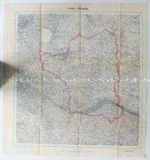
Topografische Karte des Kreises Lübbecke

Topografische Karte des Kreises Sprottau (Schlesien)
Topografische Karte des Sauerlandes

Topografische Karte des Sauerlandes

Topografische Karte der Kreise Belzig, Wittenberg und Jüterbog
Topografische Karte des Unterengadin (Schweiz)
Topografische Karte des Gebietes um Wittenberg

Topografische Karte des Gebietes um Lübeck
Topografische Karte des Gebietes um Chemnitz

Topografische Karte des Gebietes um Wittenberge
Topografische Karte des Kreises Bielefeld
Topografische Karte des Kreises Köslin
Topografische Karte des Kreises Lübbecke
Topografische Karte des Kreises Sprottau (Schlesien)
Topografische Karte des Sauerlandes
Topografische Karte des Sauerlandes
Topografische Karte der Kreise Belzig, Wittenberg und Jüterbog
Topografische Karte des Unterengadin (Schweiz)
Topografische Karte des Gebietes um Wittenberg
Topografische Karte des Gebietes um Lübeck
Topografische Karte des Gebietes um Chemnitz