Karte / Plan
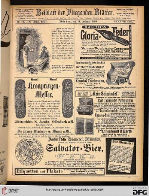
Hamel Wörden; First Edition Sheet 2221; Germany (mit Legende)
Begleittext: Geographical Section, General Staff, No 4414. Published by War Office. Copied from German Topographische Karte, Date 1936. Photolihographed by O.S.
- Reference number
-
8SL 050B Kartensammlung, 1300
- Dimensions
-
435 x 440
- Formal description
-
Aus dem Nachlaß von Pfarrer Schapal
- Material
-
Papier
- Further information
-
Ausführung: Einfarbig
Maßstab: 1 : 25 000
Anzahl: 1
- Context
-
Kartensammlung >> 10 Topographische Karten / Messtischblätter
- Holding
-
8SL 050B Kartensammlung Kartensammlung
- Date of creation
-
1944
- Other object pages
- Delivered via
- Last update
- 05.11.2025, 4:11 PM CET
Data provider
This object is provided by:
Archiv der Evangelischen Kirche im Rheinland. If you have any questions about the object, please contact the data provider.
Archiv der Evangelischen Kirche im Rheinland. If you have any questions about the object, please contact the data provider.
Object type
- Karten und Pläne
Time of origin
- 1944
Other Objects (12)

2221
2221 Hamelwörden
Nr. 2221
Grabstein 2221
![[2221] Hamelwoerden](https://iiif.deutsche-digitale-bibliothek.de/image/2/b3dd90f3-cfc4-49aa-bb88-bd7c4c699b74/full/!306,450/0/default.jpg)
[2221] Hamelwoerden
222.1. Zivilstandsregister
22.21. Wiesdorf
2.2.21. Großenmarpe
2.22.1. Allgemeines
22.2.1 Personalia

Grabstein 2221

Woerden; Naerden
2221
2221 Hamelwörden
Nr. 2221
Grabstein 2221
[2221] Hamelwoerden
222.1. Zivilstandsregister
22.21. Wiesdorf
2.2.21. Großenmarpe
2.22.1. Allgemeines
22.2.1 Personalia
Grabstein 2221
Woerden; Naerden
2221
2221 Hamelwörden
Nr. 2221
Grabstein 2221
[2221] Hamelwoerden
222.1. Zivilstandsregister
22.21. Wiesdorf
2.2.21. Großenmarpe
2.22.1. Allgemeines
22.2.1 Personalia
Grabstein 2221