Karte / Plan
Karte des Weges von Lage nach Hagen,. Lageplan und Profilriss, ca. 1:2.900, ca. 1:250
- Reference number
-
D 73, 4/5177
- Dimensions
-
Maßstab: ca. 1:2.200
- Context
-
Allgemeine Kartensammlung (bisherige Kartei) >> 22. Tit. 4 (noch nicht klassifiziert) >> 22.12. Nr. 5001 - 5200
- Holding
-
D 73 Allgemeine Kartensammlung (bisherige Kartei)
- Date of creation
-
ca. 1846
- Other object pages
- Provenance
-
Behörden, Institutionen, Einzelpersonen (Sammlungen)
- Delivered via
- Last update
- 05.11.2025, 4:13 PM CET
Data provider
This object is provided by:
Landesarchiv Nordrhein-Westfalen. Abteilung Ostwestfalen-Lippe. If you have any questions about the object, please contact the data provider.
Landesarchiv Nordrhein-Westfalen. Abteilung Ostwestfalen-Lippe. If you have any questions about the object, please contact the data provider.
Object type
- Karten / Pläne
Time of origin
- ca. 1846
Other Objects (12)

Situationsplan und Profilriss zur Chaussierung des Weges durch das Siekholz, (Amt Blomberg/Amt Schieder),. Profilriss ca. 1:1.930 und 1:121
Profilriss von der Emmer bei Schieder,. ca. 1:3.860, ca. 1:81
Plan zur Lage Wegeanlage von Kohlstädt nach Oesterholz u. w.,. Profilriss, Aufriss und Grundriss (Brücken) Situationsplan (Amt Horn),. Höhenmaßstab Profilriss ca. 1:121, Längenmaßstab Profilriss ca. 1:1.930, Situationsplan ca. 1:1.930, Aufriss, Grundriss ca. 1:60
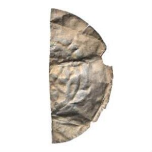
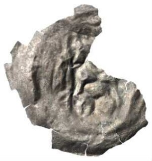
Fundmünze, Brakteat, ca. 1230-1250?
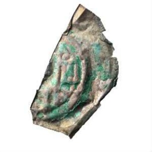
Fundmünze, Brakteat, ca. 1200 - 1250?
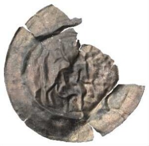
Fundmünze, Brakteat, ca. 1230 - 1250?
Fundmünze, Brakteat, ca. 1200 - 1250?
Gefängnis. Lageplan. ca. 1:250
Fundmünze, Brakteat, ca. 1230 - 1250?
Begradigung der Chaussee bei der Meierei Varenholz,. Lageplan und Profilriss, ca. 1:700, ca. 1:90
Profilriss des Kommunalwegs von Langenholzhausen nach Heidelbeck (Amt Varenholz),. Längenmaßstab ca. 1:5.790, Höhenmaßstab ca. 1:363
Plan und Profilriss zur Verbesserung der Einfahrt in Blomberg, hier in das Heutor projektiert (Stadt und Amt Blomberg),. Profilriss, Profillänge ca. 1:1.930 und ca. 1:121
Situationsplan und Profilriss zur Chaussierung des Weges durch das Siekholz, (Amt Blomberg/Amt Schieder),. Profilriss ca. 1:1.930 und 1:121
Profilriss von der Emmer bei Schieder,. ca. 1:3.860, ca. 1:81
Plan zur Lage Wegeanlage von Kohlstädt nach Oesterholz u. w.,. Profilriss, Aufriss und Grundriss (Brücken) Situationsplan (Amt Horn),. Höhenmaßstab Profilriss ca. 1:121, Längenmaßstab Profilriss ca. 1:1.930, Situationsplan ca. 1:1.930, Aufriss, Grundriss ca. 1:60
Fundmünze, Brakteat, ca. 1230-1250?
Fundmünze, Brakteat, ca. 1200 - 1250?
Fundmünze, Brakteat, ca. 1230 - 1250?
Fundmünze, Brakteat, ca. 1200 - 1250?
Gefängnis. Lageplan. ca. 1:250
Fundmünze, Brakteat, ca. 1230 - 1250?
Begradigung der Chaussee bei der Meierei Varenholz,. Lageplan und Profilriss, ca. 1:700, ca. 1:90
Profilriss des Kommunalwegs von Langenholzhausen nach Heidelbeck (Amt Varenholz),. Längenmaßstab ca. 1:5.790, Höhenmaßstab ca. 1:363