- Alternative title
-
LE / CERCLE / DE / BAVIERE
- Location
-
Deutsches Historisches Museum, Berlin
- Inventory number
-
Do 2006/989
- Measurements
-
Höhe x Breite: 69 x 58,5 cm (Blatt)
Höhe x Breite: 60,5 x 48,3 cm (Karte)
Höhe x Breite: 65 x 50,7 cm (Platte)
- Material/Technique
-
Papier, Kupferstich, grenzkoloriert
- Classification
-
Kartografie (Gattung)
- Subject (what)
-
Bayerischer Reichskreis
- Event
-
Herstellung
- (who)
-
Kartograf, Verleger: Guillaume Delisle
Stecher: Johannes Condet
Verlag: Covens et Mortier
- (where)
-
Paris ?, Frankreich ?
- (when)
-
1745
- Rights
-
Deutsches Historisches Museum
- Last update
- 24.03.2023, 9:31 AM CET
Data provider
This object is provided by:
Stiftung Deutsches Historisches Museum. If you have any questions about the object, please contact the data provider.
Stiftung Deutsches Historisches Museum. If you have any questions about the object, please contact the data provider.
Object type
- Militärgeschichtliche Karte
Associated
- Kartograf, Verleger: Guillaume Delisle
- Stecher: Johannes Condet
- Verlag: Covens et Mortier
Time of origin
- 1745
Other Objects (12)

Le Cercle de Baviere
Le Cercle De Baviere.

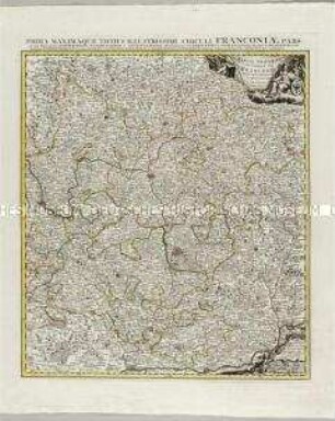
Theatre de la Guerre en Baviere et c: Le Cercle de Franconie. ca. 1:700.000. Covens/Mortier (Verlag)

Article VI. Du Cercle De Baviere

Cercle De Baviere : = Der Beyrische Kreyss
Grand Theatre de la Guerre: Partie orientale du cercle de Franconie
Theatre de guerre en Artois.
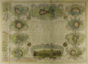
Grand Theatre de la Guerre

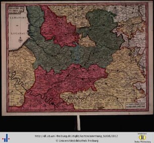
Le Cercle De Baviere : subdivisé en tous les Estats qui le Composent

Guerre de Java de 1825 à 1830. Théatre de la guerre

Carte Du Théàtre De La Guerre

Carte du Théâtre de la Guerre
Le Cercle de Baviere
Le Cercle De Baviere.
Theatre de la Guerre en Baviere et c: Le Cercle de Franconie. ca. 1:700.000. Covens/Mortier (Verlag)
Article VI. Du Cercle De Baviere
Cercle De Baviere : = Der Beyrische Kreyss
Grand Theatre de la Guerre: Partie orientale du cercle de Franconie
Theatre de guerre en Artois.
Grand Theatre de la Guerre
Le Cercle De Baviere : subdivisé en tous les Estats qui le Composent
Guerre de Java de 1825 à 1830. Théatre de la guerre
Carte Du Théàtre De La Guerre