Historisch-Politische Karte
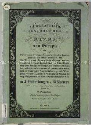
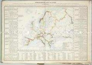
Geographisch-Historischer Atlas von Europa: Europa's Mittelalter
- Alternative title
-
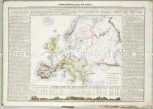
EUROPA'S MITTELALTER / mit Heraushebung der Jahre 1100, 1300 und 1500 nebst einer Skizze der Kreuzzüge und der historischen Übersicht von 900 bis 1500 n. Ch., der Jugend gewidmet / von C. Desjardins.
- Location
-
Deutsches Historisches Museum, Berlin
- Inventory number
-
Do 2006/815.10
- Measurements
-
Höhe x Breite: 49,7 x 67,3 cm (Blatt)
Höhe x Breite: 13,6 x 17,7 cm (Karten)
- Material/Technique
-
Papier, Lithographie, koloriert
- Classification
-
Kartografie (Gattung)
- Subject (what)
-
Europa
- Event
-
Herstellung
- (who)
-
Geograph, Kartograf: Constant Desjardins
Historiker, Topograph, Ethnograph: Joseph Vincenz Häufler
Kunsthandlung: Kunsthandlung H. F. Müller
- (where)
-
Wien, Österreich
- (when)
-
1838
- Rights
-
Deutsches Historisches Museum
- Last update
- 24.03.2023, 8:29 AM UTC
Data provider
This object is provided by:
Stiftung Deutsches Historisches Museum. If you have any questions about the object, please contact the data provider.
Stiftung Deutsches Historisches Museum. If you have any questions about the object, please contact the data provider.
Object type
- Historisch-Politische Karte
Associated
- Geograph, Kartograf: Constant Desjardins
- Historiker, Topograph, Ethnograph: Joseph Vincenz Häufler
- Kunsthandlung: Kunsthandlung H. F. Müller
Time of origin
- 1838
Other Objects (12)
Geographisch-Historischer Atlas von Europa

Geographisch-historischer Atlas von Europa
Geographisch-Historischer Atlas von Europa: Hydrographische Karte von Europa
Geographisch-Historischer Atlas von Europa: Ethnographische Karte von Europa

Historischer und geographischer Atlas von Europa, 1

Historischer und geographischer Atlas von Europa, 1
Geographisch-Historischer Atlas von Europa: Klima- und Naturproducten-Karte von Europa

Historischer und geographischer Atlas von Europa, 2,1

Historischer und geographischer Atlas von Europa, 2,2

Historischer und geographischer Atlas von Europa, 2,1

Historischer und geographischer Atlas von Europa, 2,2
Geographisch-Historischer Atlas von Europa: Orographische Karte von Europa. Mit einem Profil: Höchste Spitzen der Haupt-Gebirgskette von Europa
Geographisch-Historischer Atlas von Europa
Geographisch-historischer Atlas von Europa
Geographisch-Historischer Atlas von Europa: Hydrographische Karte von Europa
Geographisch-Historischer Atlas von Europa: Ethnographische Karte von Europa
Historischer und geographischer Atlas von Europa, 1
Historischer und geographischer Atlas von Europa, 1
Geographisch-Historischer Atlas von Europa: Klima- und Naturproducten-Karte von Europa
Historischer und geographischer Atlas von Europa, 2,1
Historischer und geographischer Atlas von Europa, 2,2
Historischer und geographischer Atlas von Europa, 2,1
Historischer und geographischer Atlas von Europa, 2,2